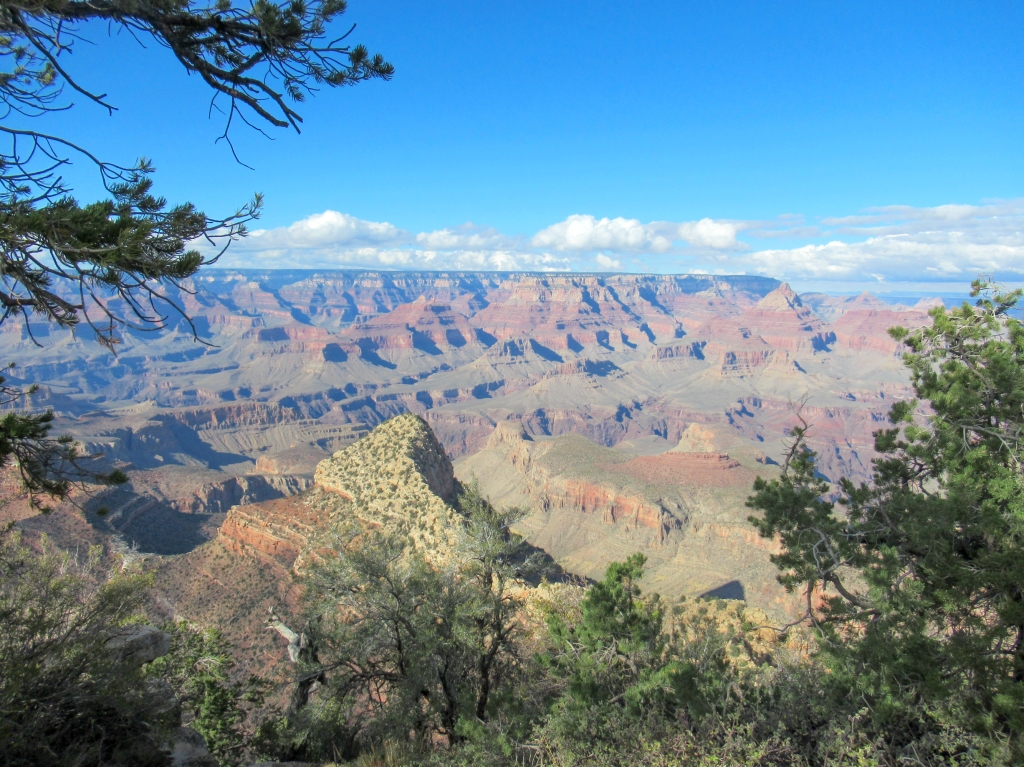
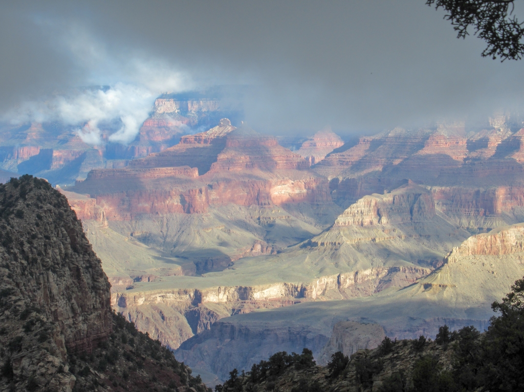
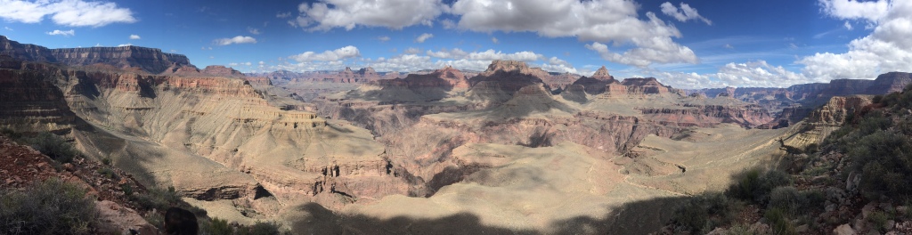
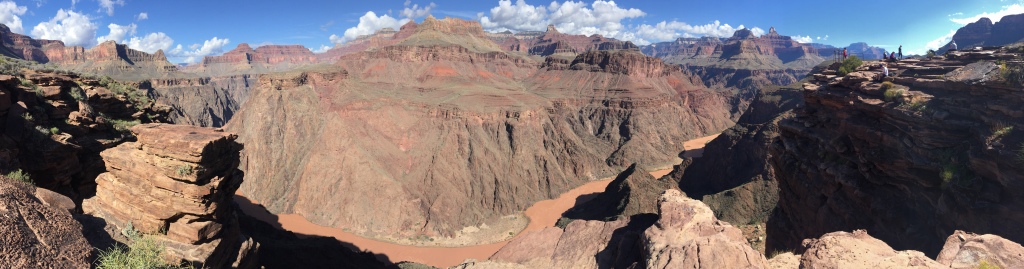
Descending into the Grand Canyon is a walk through the history of planet Earth. Every inch of the valley wall tells a story of vastly different environments. Staring at the rocks at the valley floor is peering 1.8 billion years into the planet’s past, back to a time long before even multicellular organisms existed.
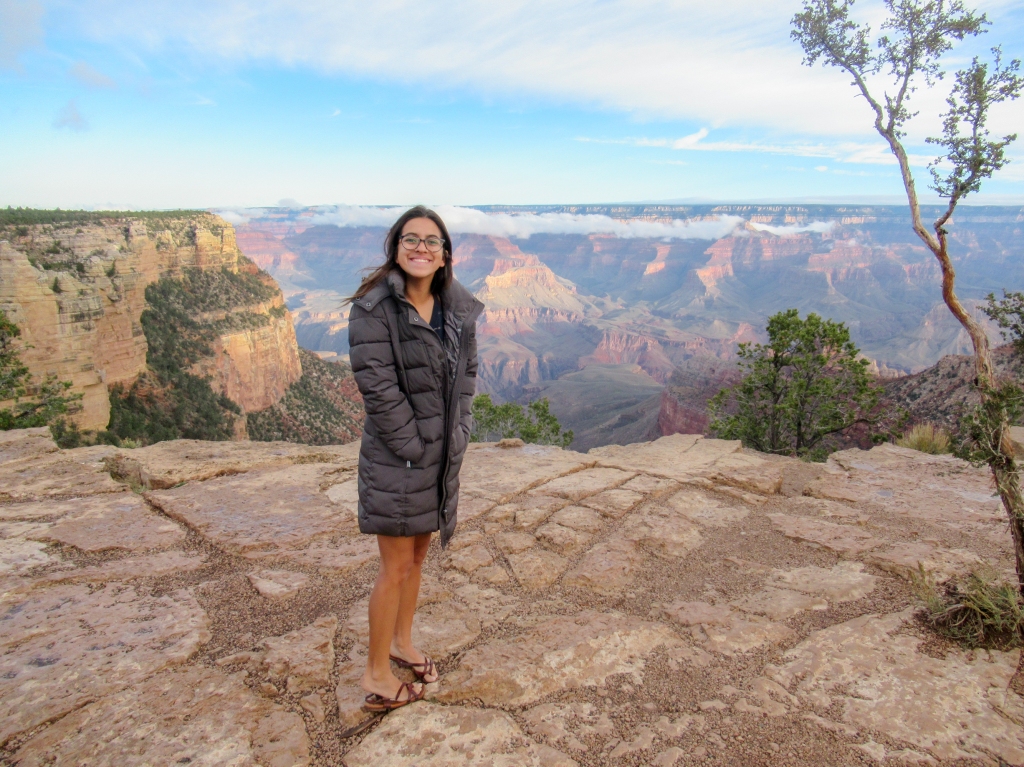
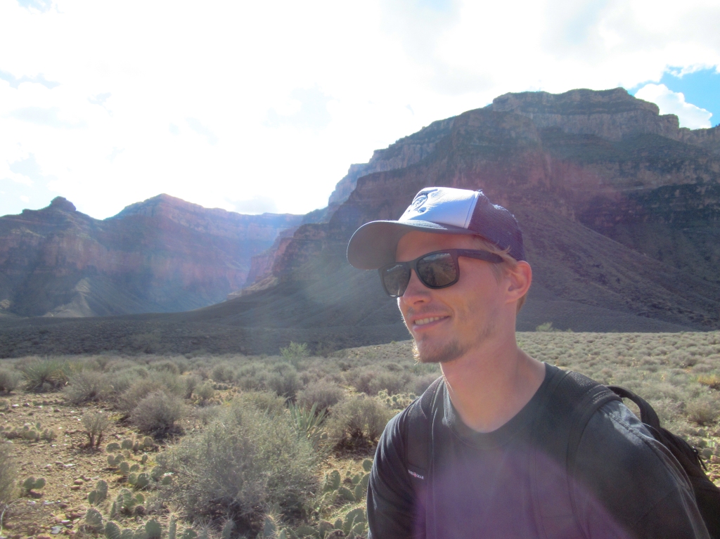
Even for those who aren’t as overly enthusiastic about rocks as I am, the Grand Canyon is quite the sight. The brain has a tough time comprehending the vastness that lies before you when peeking over the canyon’s edge.
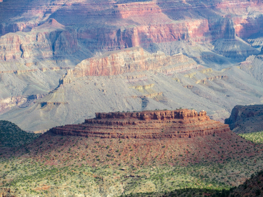
The Grand Canyon ranges 277 miles and I only saw a small portion of it. It’s big and definitely can’t be remotely explored in one trip.
I had been trying to plan a trip to the Grand Canyon ever since college, but for various reasons I was never able to make it happen. I wanted to do it right and backpack, but the permit process and my work/school schedule prevented that from ever happening.
Finally, years later, enough was enough. I had to go to the Grand Canyon. People travel half way around the world just to see it, and I couldn’t hop in my car for an 8-hour drive from San Diego?
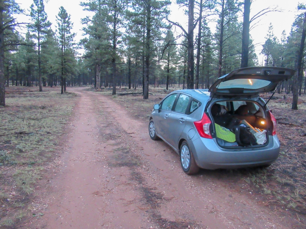
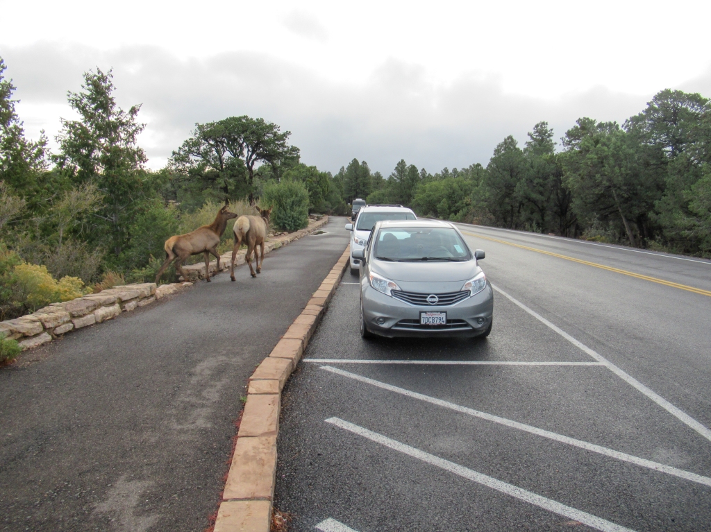
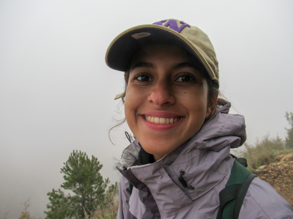
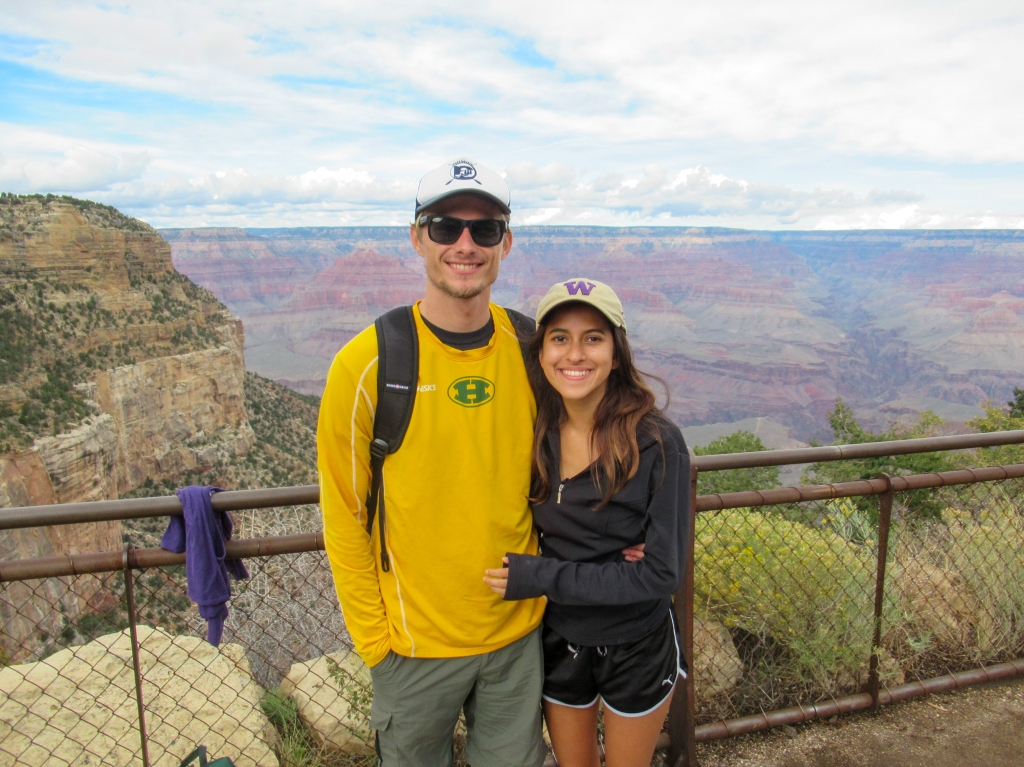
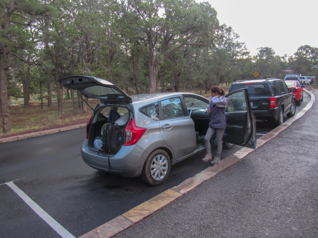
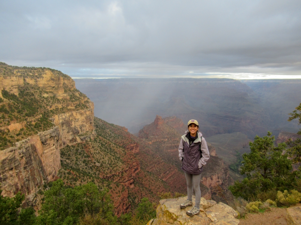
I took a day off work to make an artificial long weekend and hopped in my trusty Nissan with Madison to experience the Grand Canyon for my first time.
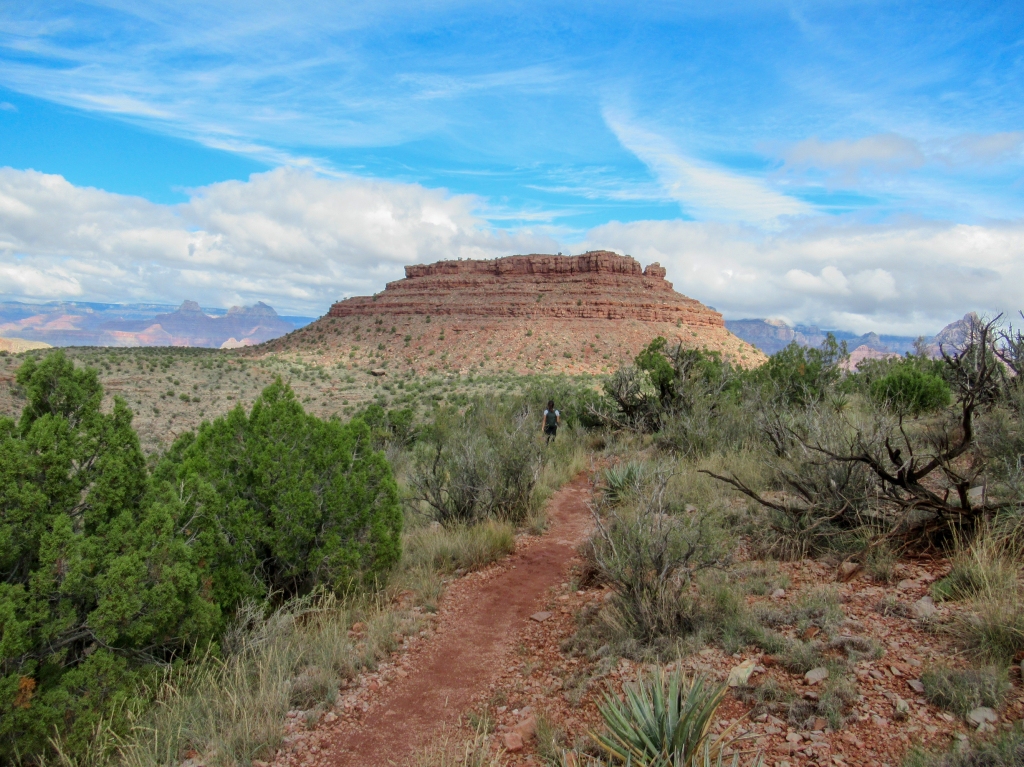
Day 1: Grandview Point to Horseshoe Mesa
Distance: 11 miles
Elevation change: 2,160 feet
Duration: 6 hours (with a nice nap)
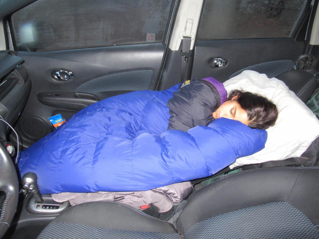
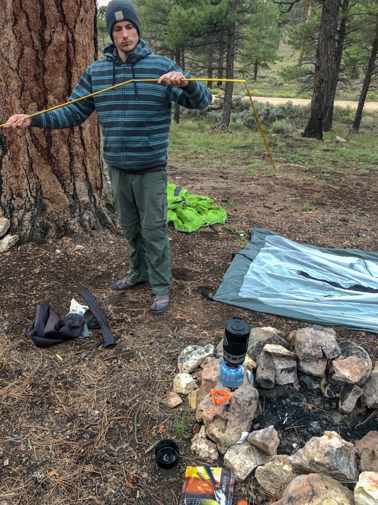
We arrived at the Grand Canyon National Park just after midnight in pelting rain. Not keen on setting up a tent in the rain after the long drive, we opted to recline the seats and sleep in the car.
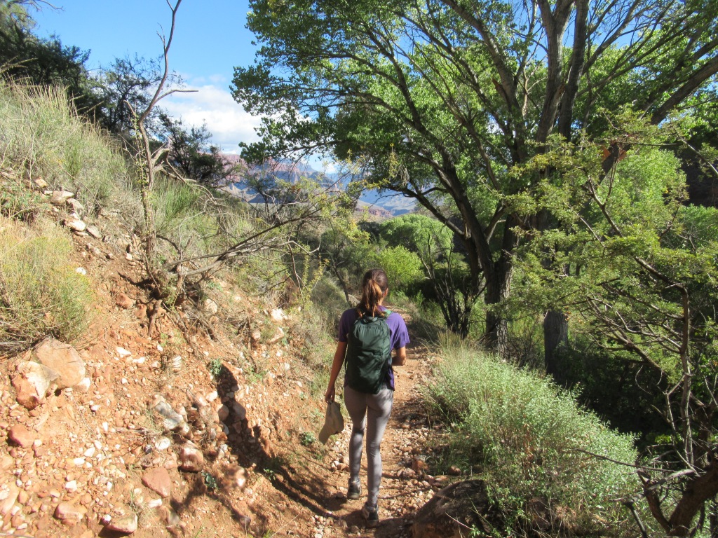
For our first day we thought it would make sense to do a “warm up” hike to get the blood going. We woke up, turned on the car, blasted the heater and headed to Grandview Point on the south rim.
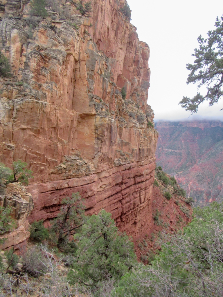
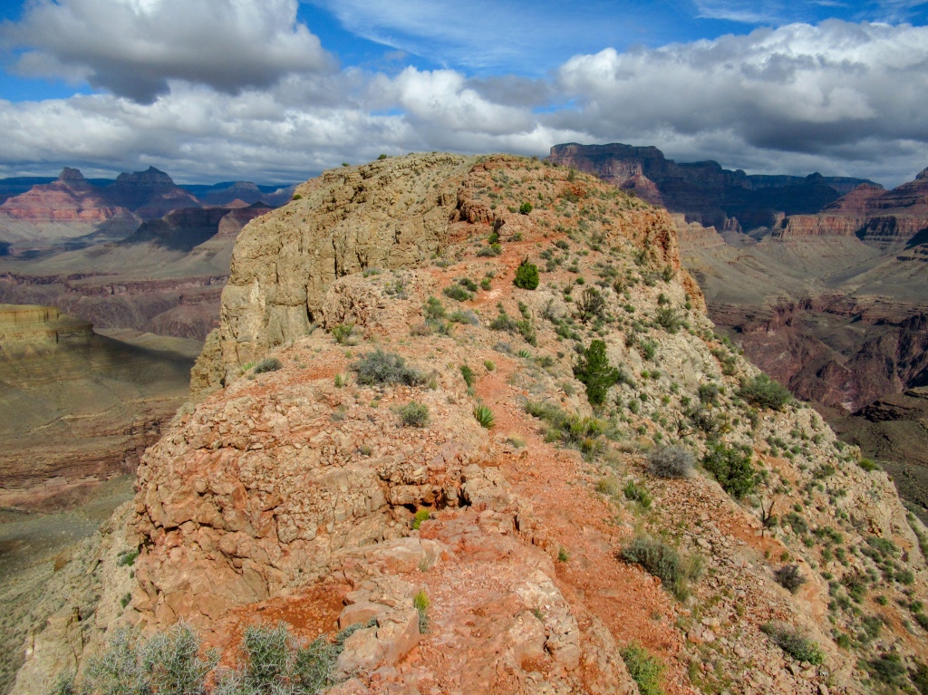
Our destination was Horseshoe Mesa — a plateau about 2,000 feet below the canyon rim with a protruding, semicircle mesa resembling a horseshoe, hence the name.
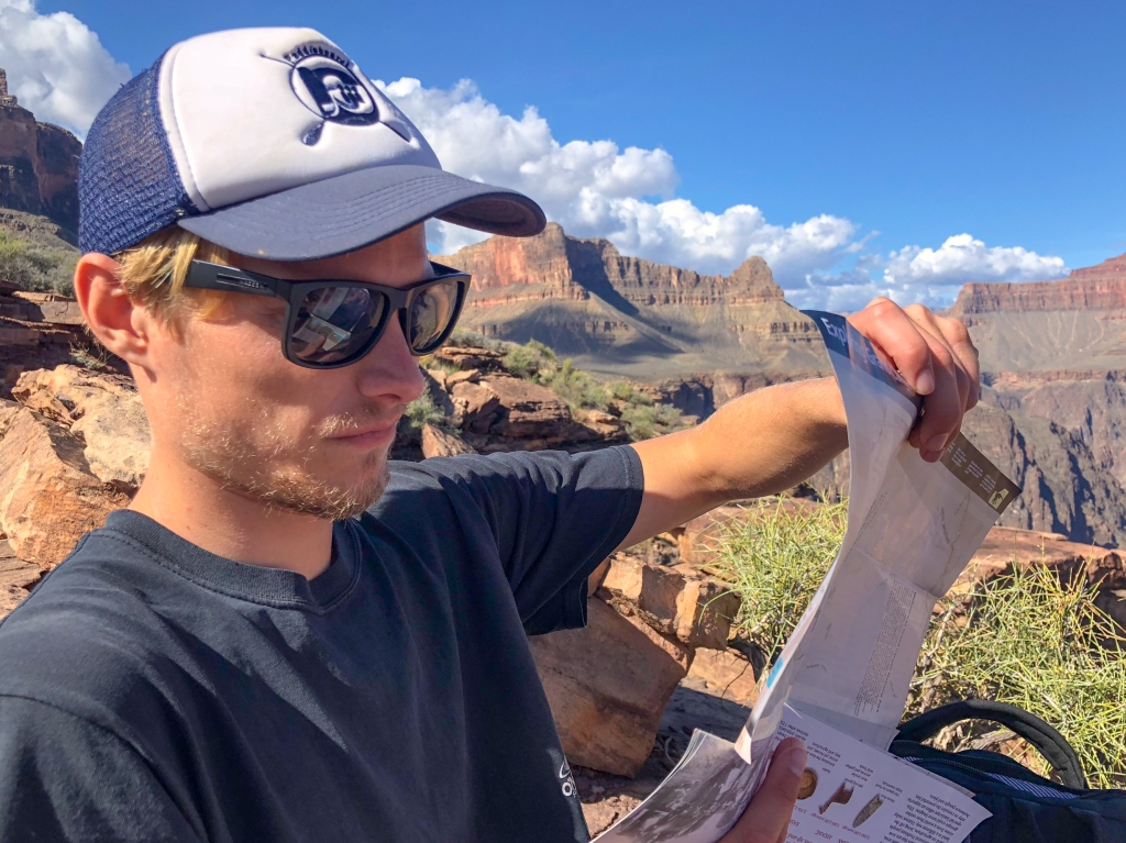
We took our sweet time making breakfast and taking frequent breaks along the hike to take in the views.
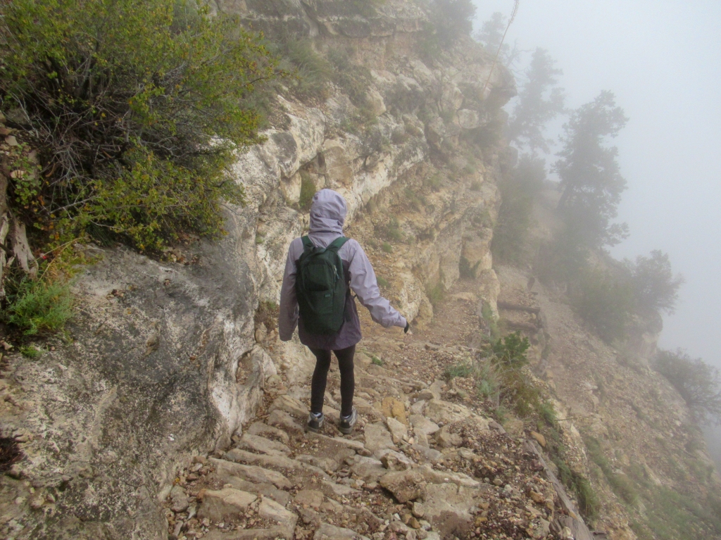
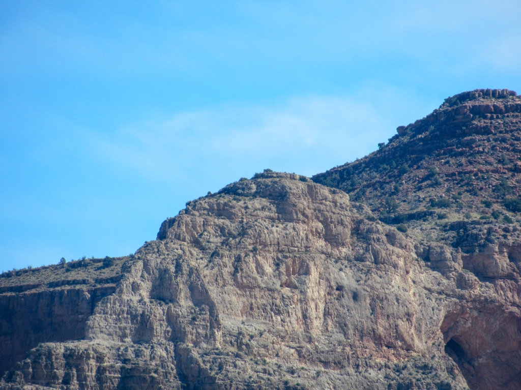
The rim at Grandview was enclosed in a fog bank, so we had little to no idea what lay before us until we descended a few hundred feet and the immense valley walls first made themselves known.
The seemingly easy distance and elevation gain turned out to be much more difficult due to the trail conditions. Much of the steep part of the trail was on cobblestone or wedged rocks, making footing more critical and climbing more strenuous.
That said, in the grand scheme of things the hike was not too strenuous as per my standards.
We made for a narrow peninsula of land that sticks out from the plateau and intermittently napped and ate lunch with a spectacular view of the canyon at our feet.
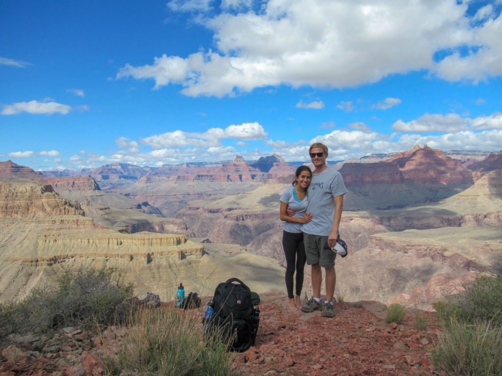
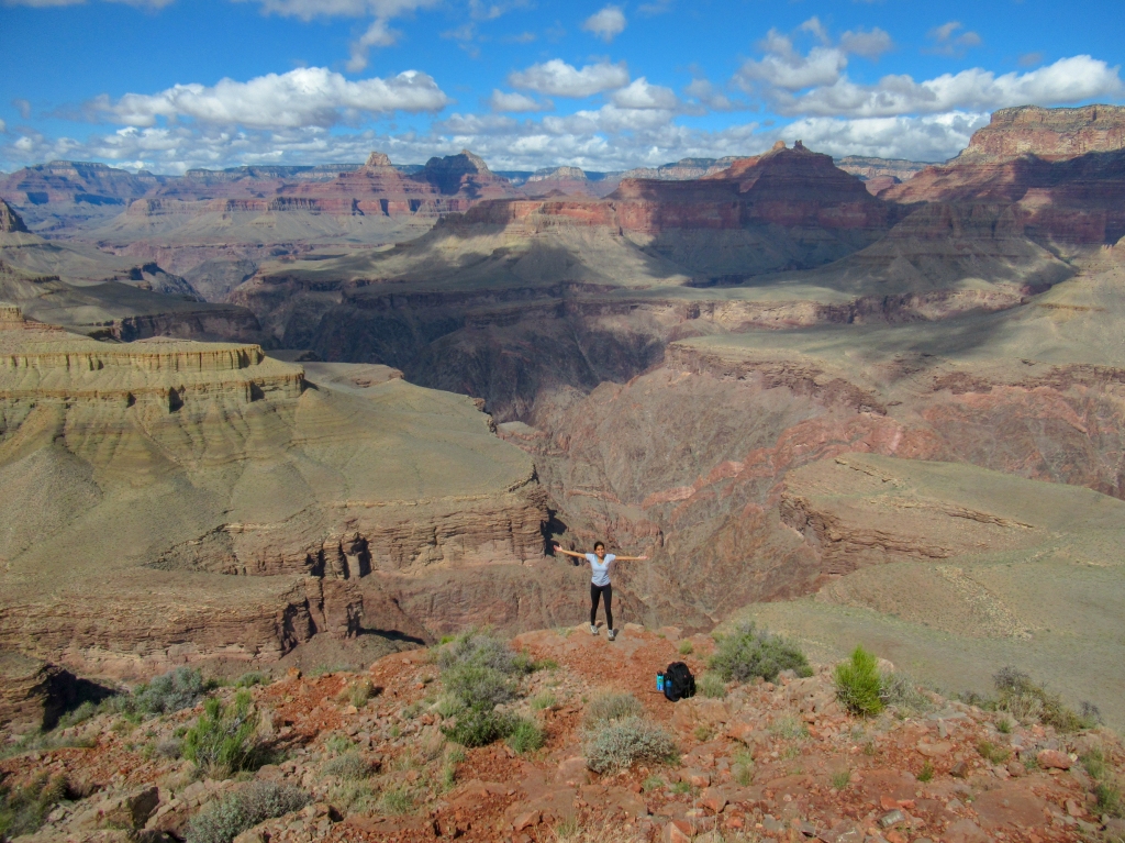
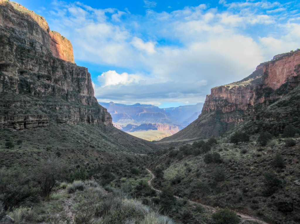
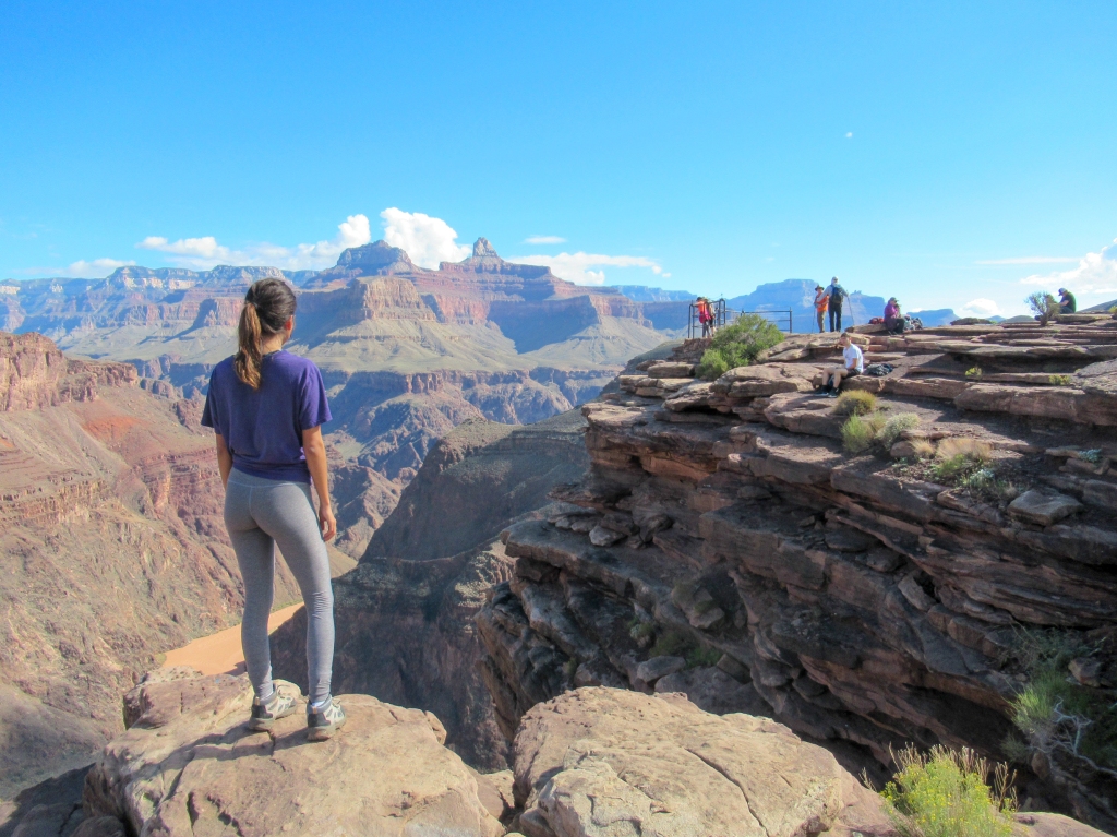
Day 2: Bright Angel Trail to Plateau Point
Distance: 14 miles
Elevation Change: 3,200 feet
Time: 7 hours
We saved the tougher of the two hikes for our second (and final) day at the Grand Canyon. We figured we would be more rested after a full night’s sleep.
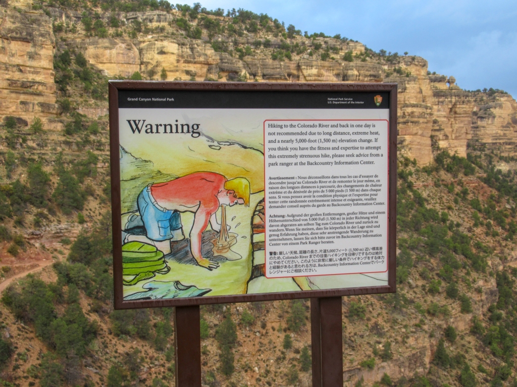
There are signs everywhere, both physically on the trail and online, saying to not hike to the river and back in one day. I wanted to hike all the way to the river and back to feel like I had truly experienced the Grand Canyon, but I deferred to the warnings and settled for the destination of Plateau Point, which was a second best option, about 1,000 feet above the river.
What on paper seemed like a tougher hike actually ended up being easier than I expected. The well-worn, dirt trails and various water spigots made for fast, light hiking. We made such good time that next time, weather permitting, I definitely would hike all the way down to the river.
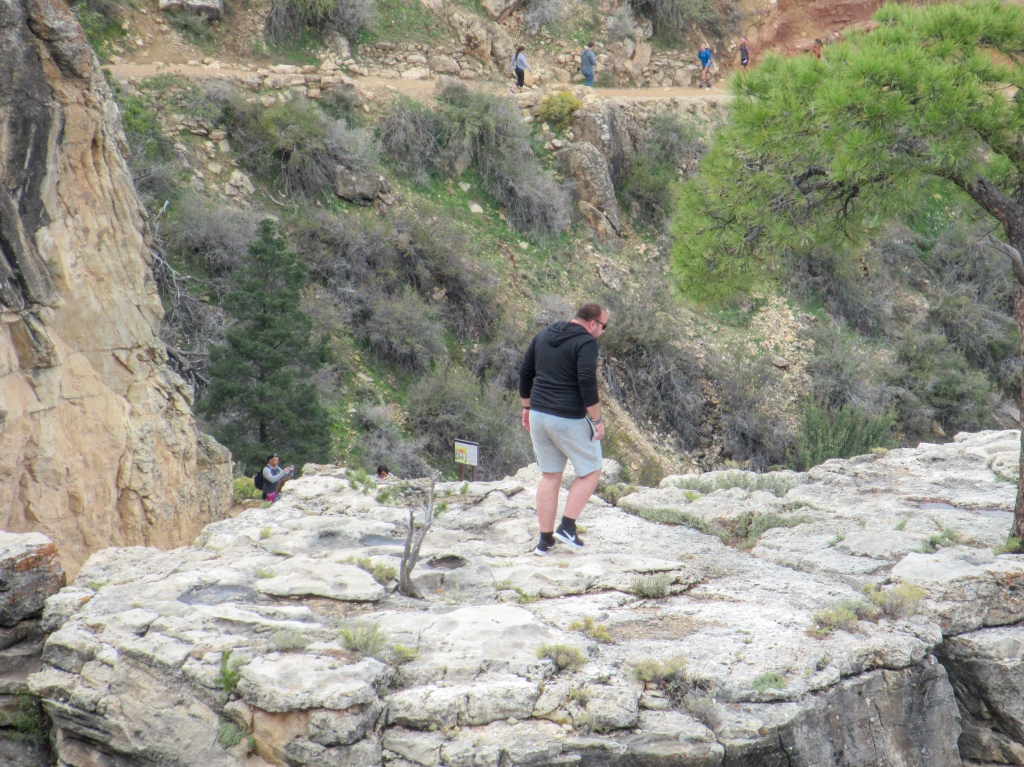
The Bright Angel Trail, unlike the Grandview Trail, is one of the high-traffic trails in the park. The views of the canyon were probably slightly better, but solitude was tough to come by.
The deeper in the canyon you go, the relatively more serious the hiker that you will come across, but on the way back up, as you get closer to the top, the brand of hiker gets a little more obnoxious. You get everything from the loud eighth grade class field trips to elegantly dressed foreigners, and of course those real smart tourists that like to test their luck on the cliff edges.
Still, the crowds did not rival what I have seen on my various trips to Yosemite, so I wasn’t bothered. People that are willing to hike long distances tend to be friendly, so there was mostly just smiles and ‘howdies’ on the trail. I did also jump into a funny conversation about Kanye West’s White House visit, which was sparked by an Obama supporter with a thick southern accent (don’t come across that every day).
The Grand Canyon certainly did live up to its name on my first trip. It was nice to see the canyon in person after having seen photos and movies, even views from airplanes. It truly is a world-renowned treasure that we have relatively in our backyard. Can’t take that for granted. I already have the itch to go back and complete the rim to river hike, or even do an overnight trip if I can attain a permit.
We’ll be back.

EQ, You do know that the Grand Canyon is my most-favorite place on earth, don’t you? I’ve hiked in from both sides, and I think you meant to say the Elk are on / in the North Rim’s forests, as the South Rim is an entirely different ecology and flora / fauna. But maybe not…..and I hiked out just once, when I was in good shape, and it ain’t no fun, except for the views.
The hike you just made is really good enough. But I recommend to ride down on a mule, and hike out, if you must do the hike. going down, I suffered badly from jammed-knees and bad feet and worn-out muscles, a Q-family trait, I fear, and isn’t worth the inner-reward of having accomplished something big. Gloria and I hiked in before we were married, and I was hurting for two or more days later, missed out on some great side canyon hikes downstream from Phantom Ranch that trip.
I suggest, to pay for a donkey ride down, or a raft ride to Phantom Ranch, and then hike out, if you must hike. I did raft from Lee’s Ferry to Phantom Ranch on one trip (of 8 raft trips I’ve made), and I’m of the school of thought that believes the wear and tear on the knee joints hiking down isn’t worth any payoff…like today, my one knee is bone-on-bone and always painful, and I know that hike is partially to blame….and then, to carry provisions and camping gear, in 100-degree heat….you get the picture.
Also, there are a few incredible, serious trails that run along portions of the river, or that can be reached from the river and head to the rim, and also loop around the inner canyon and head back to the river on both sides of the canyon, most accessible only by boat. There’s one (old Indian or miner’s) trail that goes to the river from the North Rim, and I’m pretty sure I could point it out to you someday.
There are many Anasazi (Those Who Came Before) ruins deep in the canyon, and a very sacred salt mine just up-river and near the confluence of The Little Colorado and The Colorado rivers, which is off-limits to all boat-trippers today; but when I first took the raft trip in 1972, and the boat-rowing people liked a special group, they could choose to stop there and check it out, and only on that first trip the boat stopped and we were able to go into the mine. Ancient carvings and picto-graphs were etched or carved around the opening to the only spot for hundreds of miles where people / Indians could get salt. And so, it was a sacred spot to the Indians, who would come there from far away to get salt they needed to survive. So it was a place where no one fought, but went there in peace. Anywhere else, and they would have been fighting to the death, so much rivalry and warring forever between all Native American Tribes, kill or be killed. But not at the salt mine.
I got stories, and I got photos of so many beautiful spots, I’d love to give you my guided photo tour someday, if you’re ever interested.
There are canyons running off on both sides of the river, and I’ve explored them all, but not in their entirety. I really could have skipped much of the world travel I found time to do, and instead spent weeks and months in the G Canyon. And it’s usually warm to hot at the bottom year-round, even when there’s snow on the rims.
The Havasupai trail is fantastic all the way to the river…..anyway, really enjoyed being at the G C again, through your’s and Madison’s eyes. Love, Dad
LikeLike
Hey Dad,
Looking forward to hearing from more Grand Canyon stories.
Would love to see some of the Anasazi ruins.
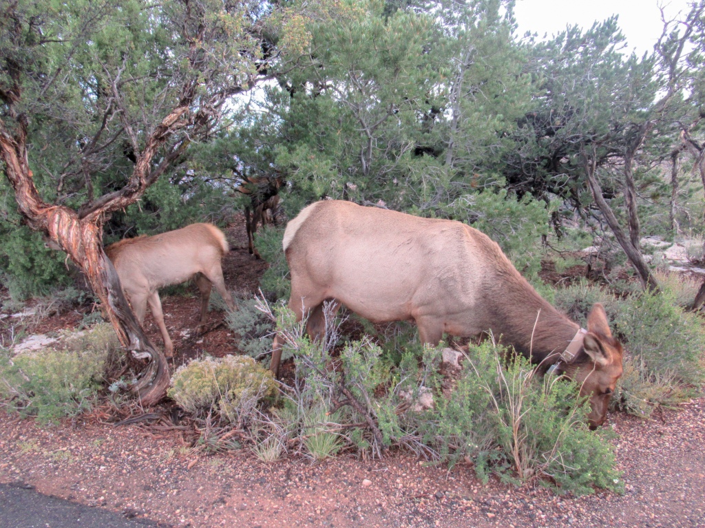
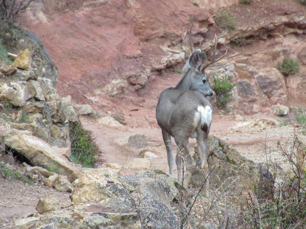
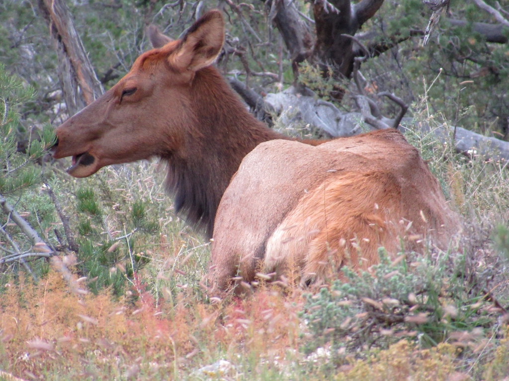
And actually, it was in fact the south rim where I saw the elk.
Love
Evan
LikeLike
Great story, Evan. Dan and I stayed at a rim cabin next to the Bright Angel trailhead for four days in April. We go about every four years and never tire of it. However, I was shocked to hear that the admission to the park is about to go up to $70 per head. Sadly, this will keep a lot of people from going in there. (Not us as we have the golden pass.) Keep travelin’ and writin’.
LikeLike
$70/ person, wow. It was $35/car for us I believe.
LikeLike
Wonderful photos and story. Fran (Geography Major) will love this one. Glad you two were able to squeeze in the trip. XO
LikeLiked by 1 person
Very professional … You obviously have the Quarnstrom writing gene!
LikeLiked by 1 person
Thanks, Lee.
LikeLike