Quick facts:
- Distance: 23.8 miles
- Elevation gain: 8,000 feet total (according to AllTrails — lots of ups and downs)
- Water: 5-7 liters
- Time: 14 hours (5.5 hours to Villager Peak; 2.5 hours to Rabbit Peak, 2.25 hours back to Villager Peak, 3.75 hours back to trailhead)
~~~
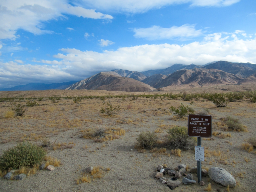
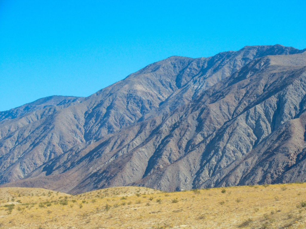
In the remote northeast corner of San Diego County, the Santa Rosa mountains tower above the heat-scorched desert valleys of California’s interior. Prominent peaks line the mountain ridges, providing expansive views of the surrounding terrain.
Standing 6,660 feet tall, Rabbit Peak is one of the many high points that rockets up into the sky when staring up from the valley floors. It would be the highest point in San Diego County were it not just a mere several hundred feet beyond its borders.
Standing between Rabbit Peak’s trailhead and its summit is nearly 12 miles of water-less, shade deprived terrain and a monstrous 8,000 feet of vertical climbing. Rabbit Peak is a challenge like no other that I have experienced in San Diego. It’s not for the faint of heart.
If you are up for the physical challenge, the mental challenge must also be overcome. In the wide-open desert, distance and height can be deceiving. The effort required for the peak, that from a distance seems reasonably attainable, can only be appreciated once lugging a heavy pack up its slopes.
However, the misery of gaining the peak is also what attracts peak baggers like myself to take on its test. It’s a test of mental and physical ability that bestows the tangible award of sweeping desert views, while simultaneously providing the intangible sense of fulfillment and accomplishment.
Part 1: Attacking Rabbit via Villager Peak
Rabbit Peak had been on my to-do list for the entire winter. I had been peering up to its peak during my various trips around the Anza Borrego desert, but adequate conditions and my availability had just not aligned.
By the time April rolled around and the blistering summer temperatures had returned to the desert, I figured that my desert treks were over until the fall. However, keeping a watchful eye on the weather forecast, I spotted a low pressure system approaching from the Pacific Ocean that was set to bring rain and heavy cloud cover to Southern California, and best of all it was set to make landfall on a Saturday when I had time off work. A short window of relatively cool weather was about to blanket the desert, just enough time for me to squeeze in a climb to Rabbit Peak.
I rushed to the grocery store to get food, gathered my belongings, and set out to attempt a hike that I knew would put my conditioning to the test.
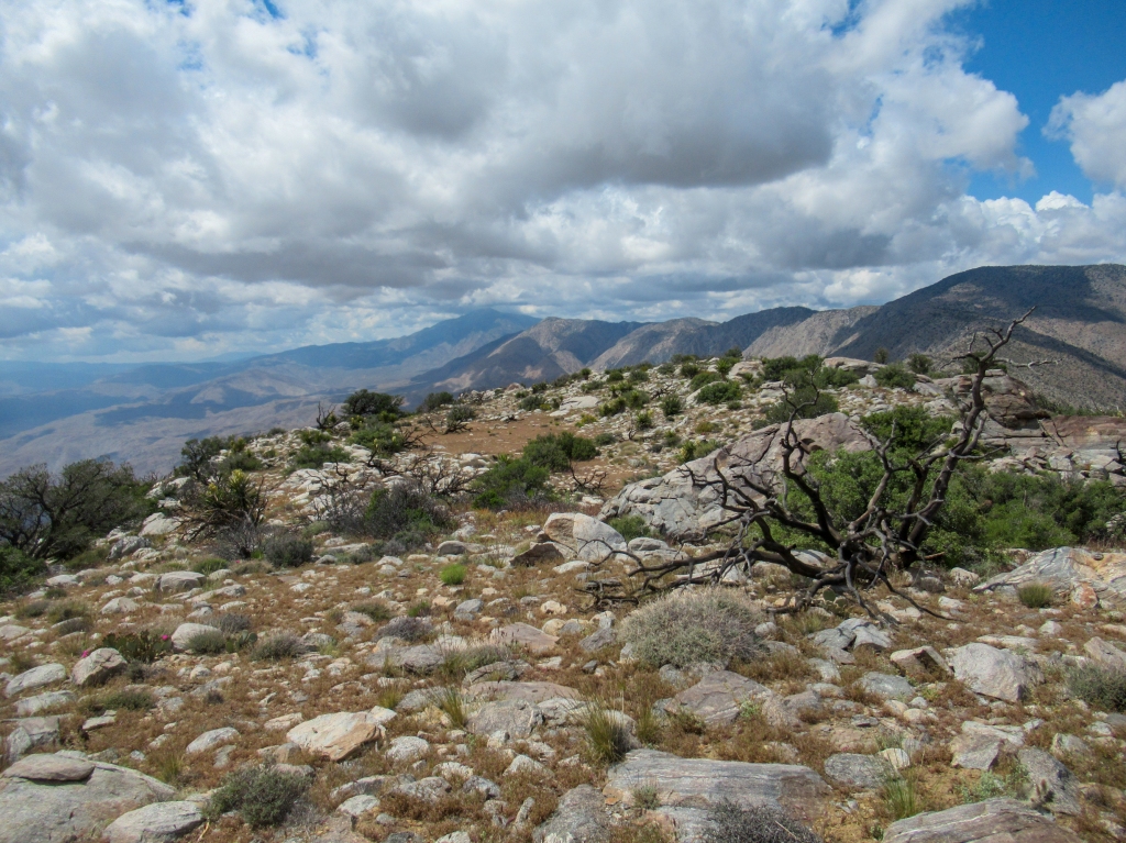
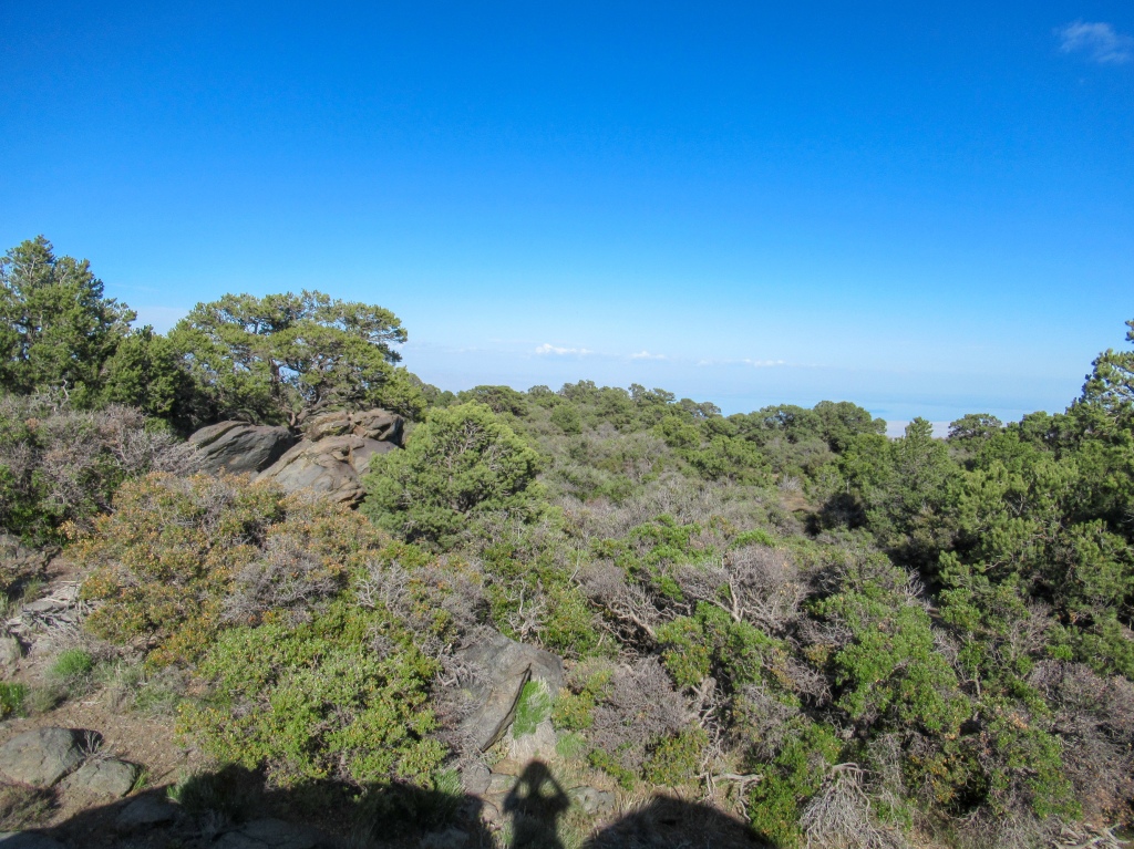
The hike starts out on the valley floor at the mouth of Clark Valley and follows a distinguished, single ridge up to the 5,700-foot Villager Peak. The ridge resembles a massive staircase of escarpments broken up by short, steep connector trails. As you follow the ridge high above the valley floor, it becomes more prominent and vertical, with certain sections of the hike hugging the cliff’s edge as it dramatically falls thousands of feet below.
My plan of attack was to do an overnight trip, first summiting Villager Peak and caching my gear, then summiting Rabbit Peak before returning to Villager to set up camp for the night. Then, in the morning I would scoot off the mountain with a quick 5,000 foot descent before the desert sun could catch me.
I packed extremely light in the gear department, bringing only the bare essentials because I was going extremely heavy in the water department. I packed seven and a quarter liters of water, which translates to 16 pounds. I have never attempted an overnight hike that included this much mileage and elevation gain, so I erred on the side of caution and brought a lot of water, about twice as much as I would bring on a typical backpacking trip.
As far as food went, I stuck with ready to eat snacks. As nice as a warm meal is before bed, water to cook with and cooking supplies are weight that I had no intention of carrying, so I left those items at home.
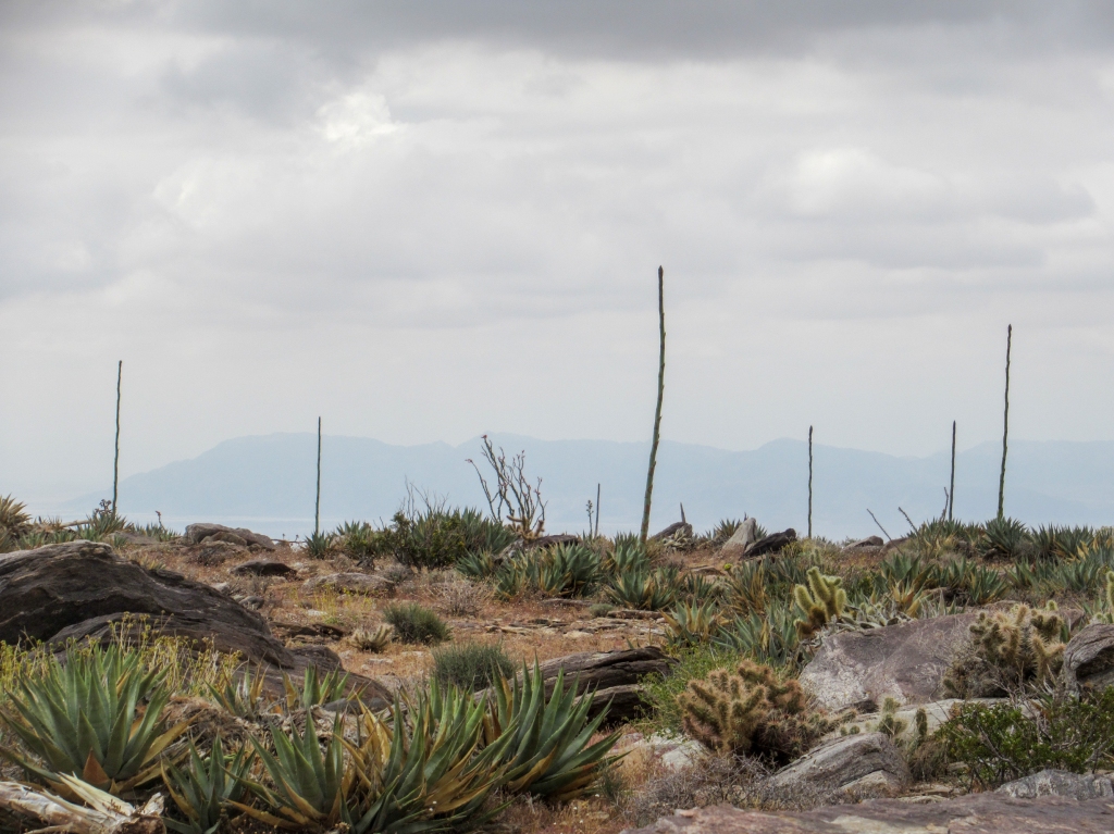
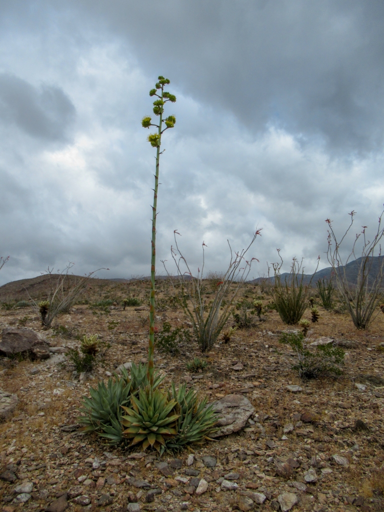
The most interesting part of ascending this ridge to me was the varying ecosystems that come and go as you gain elevation. From afar, the ridge seems to be devoid of life, but upon closer inspection that is not the case at all.
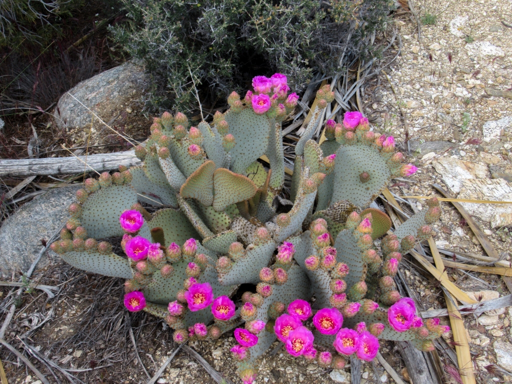
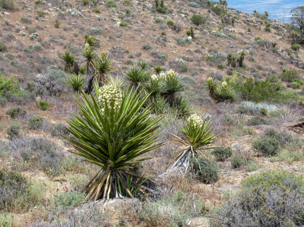
With each increment of elevation gained you enter a new world of flora and fauna, each more intriguing than the last. The cholla and ocotillo dominated terrain of the lower elevations give way to impressively tall, thriving agave, which then give way to vivid flowering cacti, followed by thick, blooming yucca trees. As you near the top, the yucca are overcome by the pinyon pines, growing sturdier and thicker the higher you go.


Part 2: The soul-crushing ridge to Rabbit Peak
I arrived at Villager Peak exhausted, beat and short of breath. Climbing nearly 5,000 feet with a heavy pack had kicked my ass and chafed a fresh blister on my left heel.
That said, there still was some gas left in the tank and my goal still laid ahead of me.
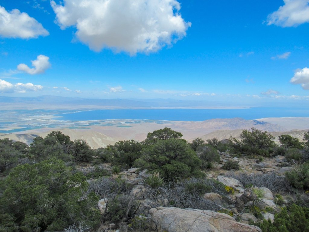
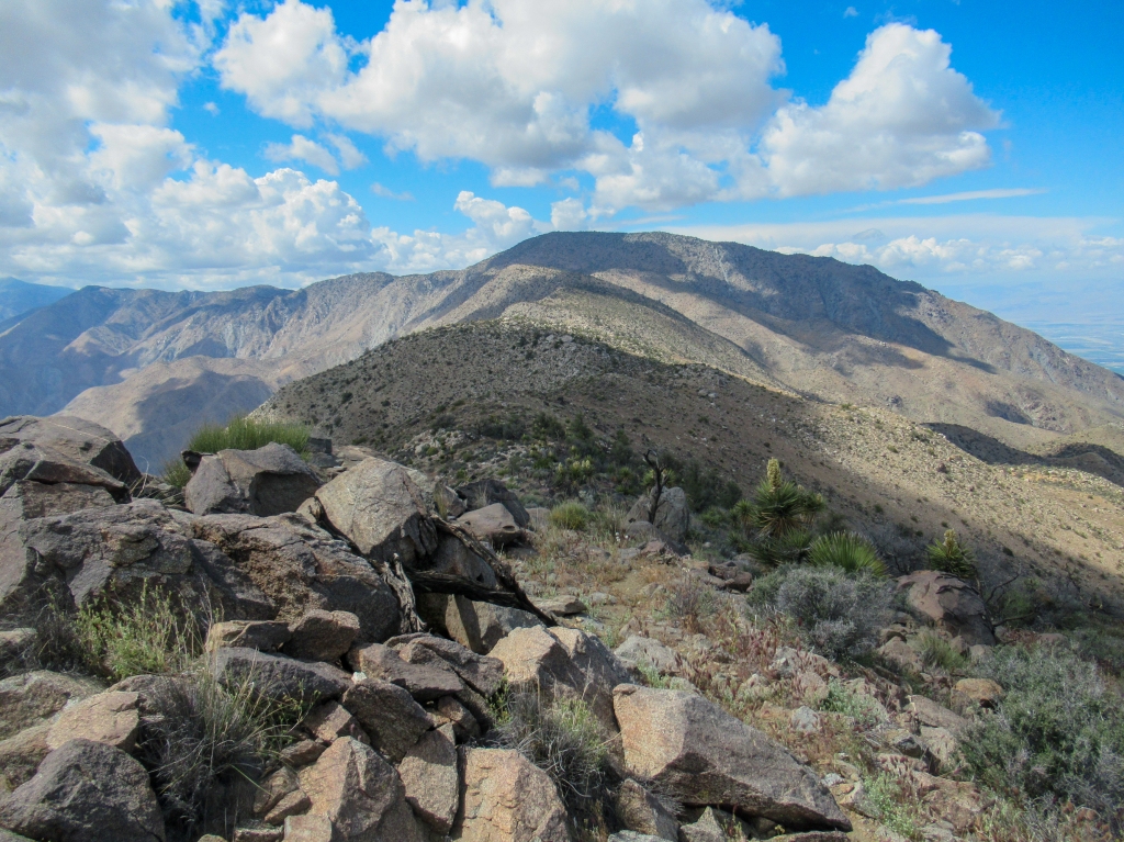
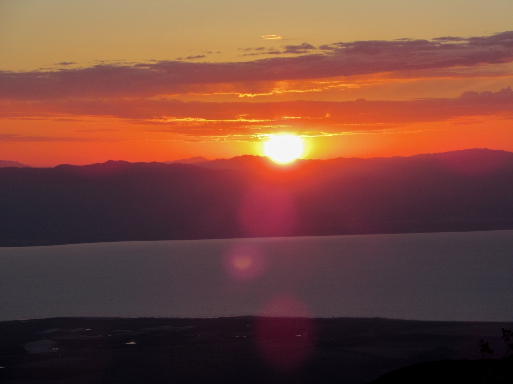
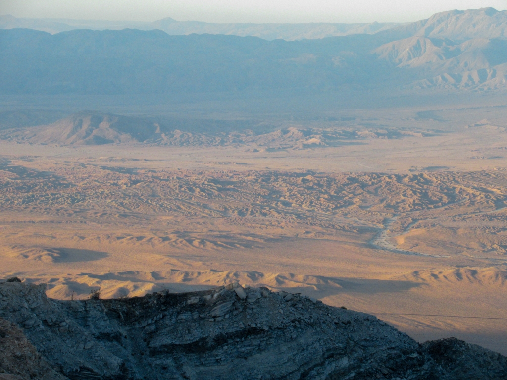
I took a half hour to soak in the views and catch my breath. The scenery stretches 360 degrees with Coachella Valley, the Salton Sea, and Joshua Tree to the east. To the west the houses of Borrego Springs were nothing but dots in a sea of sand, dwarfed by the towering mountains of San Diego’s coastal ranges. To the north lies the infamous Rabbit Peak, with the 8,000-foot Toro Peak acting as a backdrop.
The climb up to Villager was a slow trudge that took me about 5.5 hours, more or less what I was expecting. I had six hours of daylight remaining to out-and-back Rabbit Peak, so I figured a quick 30 minute nap would do me well.
I found a shady pinyon pine overlooking Clark Valley, set an alarm, and dozed off with a refreshing mountain breeze grazing my skin.
When I felt that sufficient energy had been restored, it was time to continue. Rabbit Peak sits only 900 feet higher than Villager Peak, but the 3+ miles that separate the two are a series of falls and rises that add an absurd amount of elevation gain to the hike.
If you didn’t know any better, the hike appears to be relatively flat from the perspective of Villager peak, but the ridge’s spine has about nine high points with dips between them that fall hundreds of feet at times. After working to gain that hard-earned elevation, it is soul crushing to repeatedly have to lose and regain it.
With the bulk of my gear cached at Villager Peak, I was hiking much lighter on my feet. I brought my pack, about 2.5 liters of water, and all my food. It made lugging my body up the steep slopes slightly easier.
As with all trips out to remote parts of nature, there is always unforeseen obstacles to overcome and on this portion of the hike, the seemingly harmless foxtails were the unsuspecting culprit.
The ridge has a faint trail at times, but mostly you are just navigating through the path of least resistance. The ridge line was absolutely riddled, and I mean riddled, with dried foxtails ready to detach from their stems. It made hiking that much more painful as my socks acted as magnets and collected dozens of them by the minute. Stopping to remove them every time they bothered me would perhaps jeopardize my summit of Rabbit Peak since daylight was waning.
I pushed on as best I could and surely enough made it to Rabbit Peak, but not before a brutal ascent of the final ridge, which was perhaps the steepest of all on the entire hike.
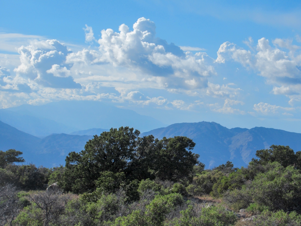
The views from the top of Rabbit Peak are comparable to those of Villager, except the added elevation gain gives you a peek of the 10,000+ foot behemoths of San Jacinto and San Gorgonio to the north.
I enjoyed the views for as long as I could, signed the peak log, and it was time to head back to Villager before the daylight escaped.
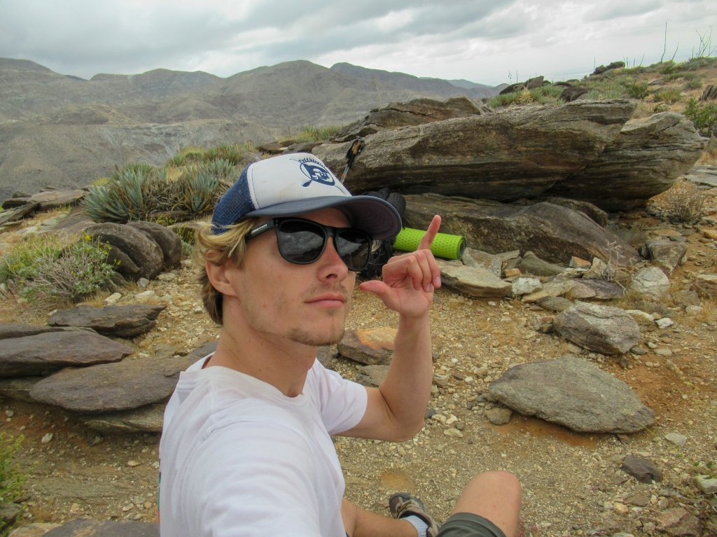
As I was departing Rabbit Peak, I came across some creatures that I hadn’t seen all day: three humans.
I saw them pull into the parking lot about 45 minutes after I started the hike and they didn’t catch me until the summit of Rabbit Peak. We exchanged photo duties and bid farewell. They lingered on the peak, apparently not opposed to hiking back to Villager in the dark.
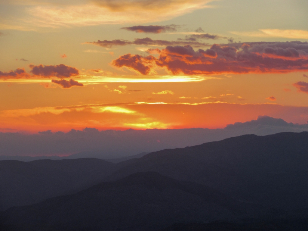
I retraced my steps back to my belongings, regaining the elevation that I had lost, and losing the elevation that I had gained through the rollercoaster ridge. The sun set to the west, illuminating the few clouds that remained through a stunning range of colors that evolved as the sun’s angle grew lower.
My tent was pitched with the last moments of light, before being enveloped by dark. The timing couldn’t have been more perfect, almost too perfect. For all that could have gone wrong, I would say things went superbly on day one of Rabbit Peak.


Part 3: Aching for shade
For the second day of the hike I had the relatively simple task of descending 5,000 feet back to my car, before the heat of the day took hold. I was hiking with significantly less water and food weight, and all of the uphill sections were behind me.
However, having kept a close eye on the forecast before starting the hike, I knew that Sunday was going to be warmer than Saturday when I started the hike. The thick clouds brought in by the low pressure system on Saturday had vanished. The desert was more or less returning to its typical May climate with highs forecasted in the low 90’s on the desert floor.
My goal was to get an early start, well before the sunrise, and get back to my car before the heat could catch me.
I set my alarm for 4:30am and began to ready my bags, but first I unzipped my tent and took a look outside. The night sky was stunning, with the Milky Way stretching from horizon to horizon. I couldn’t remember the last time I saw the Milky Way so clearly. Those 30 seconds of staring at the sky felt like an eternity and ended up being the snapshot memory of this trip that remains most vivid in my mind.
With no time to waste doing too much stargazing, I rounded up my gear and began the long descent back to my car.
Even at five in the morning the air was already feeling warm. I knew that regardless of how much progress I would make before sunrise, there would be a few hours of hot, sticky desert hiking in store for me. I don’t fare too well in the heat, and my fair nordic skin doesn’t last too long in it either.
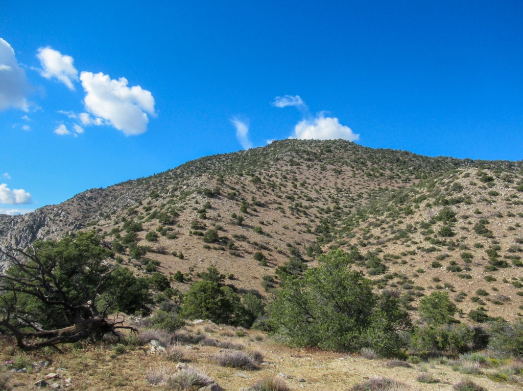
As I descended the ridge, the sun rose higher, and for a good while I was able to outrun it. As it would overtake me, I would drop down a few hundred feet and buy myself another fifteen minutes of shade from “Mile High” Mountain, which was acting as my shade barrier due east.
Surely enough, eventually the sun rose high enough that no mountain could save me. I put another layer of sunscreen on top of the two previous layers from Saturday (and presumably a few layers of dirt), bracing for the last few miles of shade-less hiking before I could get to the mobile oasis that is my Nissan Versa.
I took breaks near anything that remotely produced shade, lying down near small rocks and hiding behind the thin branches of the ocotillo plants.
Still with plenty of water remaining, I liberally replenished the liquids that my body was losing and scooted my way down the mountain, completing the hike from Villager Peak in about 70% of the time that it took me on the way up.


Once is enough, for now
Rabbit Peak was all that I had imagined and more. As I leaned against my car, waiting for my AC to kick into gear, I stared back up at the snaking ridge that I had just hiked and was overcome by a great sense of accomplishment. I had pushed my personal limits of backpacking, as far as distance, elevation and difficulty go, and done it relatively without a hitch and solo for that matter.
I love Anza Borrego and all the treasures that are hidden out in San Diego’s desert, so I was happy that I got to give it one last hurrah before the summer heat truly sets in and turns the most simple hikes into survival situations.
As with most hikes that are this challenging, I didn’t complete Rabbit Peak with the urge to do it again anytime soon. Going through the physical pain once was enough for me and made me a happy camper.
However, as I was standing on Rabbit Peak’s summit, I was definitely subconsciously eyeing the countless ravines, valleys, and peaks of the Santa Rosa Mountains, unknowingly plotting the next adventure come wintertime.
~~~
Note: I know Rabbit Peak is in Riverside County, but 95%+ of the hike is in San Diego County, so I stand by the title of the post.

I was in my late fifties when I managed to hike Villager Peak. It was a normal temperature when I started, wearing t-shirt and shorts. As I got higher it got colder and colder so I could only stay at the summit for a few minutes. The clouds overhead seemed close enough to touch. Don’t think I’ll ever make Rabbit Peak, so thanks for this beautiful account of _your_ trip.
LikeLike
Thanks for reading and for the story.
LikeLike
On the winter solstice in 2020 my wife and I did villager peak.
She was late 50s and I was 67. Pretty tough hike, it’s 85% mental.
About a year later I did a solo death March loop of palo verde canyon, Rosa Point, Mile high Peak, crossed rattlesnake canyon and back down villager peak trail… even tougher.
LikeLike
Sounds epic !
LikeLike
Great trip report !! Now go back when your 50 and let me know. It is a special area with the views and the sleeping circle and the Agave roasting pits. Good job, great photography
LikeLiked by 1 person
If I can still backpack that kind of elevation when I am 50 that would be a great success! Where did you find most of the agave roasting pits and sleeping circles on the hike?
LikeLike
Thumb’s up to you. I know it’s the hardest hike in SD, The View is topps and even found a couple of Indian Circles. For me was Water, Only bought 1 gallon but at 90 degrees it went quick. If you know your body then hike this summit, then think again. Don’t yes uncle…..
LikeLike
I didn’t see any rock circles, were they on the peak or on the way up?
LikeLike
Great story, thanks for sharing. Also, kinda good to know that Rabbit Peak is NOT on the Sierra Club’s 100 Peaks list (which I’m lazily working on) for San Diego County, and Villager can be done as a day-hike then. 🙂
LikeLike
Yup!
LikeLike
I don’t think I will try the hike, but I loved reading about it. Great writing and photos. Thanks.
LikeLiked by 1 person
Thank you.
LikeLike
A hike well done, and a story well written complete with evocative photos.
LikeLiked by 1 person
Way to go Bro’ ! I am impressed ! Very impressed ! Your photos and words are the bomb ! This coming from a man who was a Park Maintenence Aid in ASDSP back in 1977 ! Sorry that I ever had to leave Borrego. PS I’m partially responsible for identifying the Swainson’s Hawk Migration that takes place every Spring out there.
LikeLike
Cool!
LikeLike
Hi Evan. Nice report. I’ve done the hike to Villager and back as a day hike but have yet to make it all the way to Rabbit. I enjoyed your post and photos.
LikeLiked by 1 person
From UNCLE LEE: Man, you sure love that desert! Your enthusiasm for trudging around that beautiful but often scorching place comes through wonderfully in your writing … and in your fine photography. The desert flowers are so lovely and you’re lucky to be so close to a wild place that you love! You know, the secret to becoming a great writer is to keep writing … so, Keep Writing! Honestly, you get better and better with each new chapter detailing your adventures.
LikeLiked by 1 person
Thanks, Lee. Yes I have grown to love the desert. I’ll keep writing. Thanks for the encouraging words.
LikeLike