Trip summary
Distance: 12.2 miles
Elevation: gain: ~4,500 feet
Time: 9 hours
While San Diego may not boast the highest peaks in southern California, it definitely does not lack steep mountainous terrain. With more than 60 peaks in the county that crack the mile-high barrier and mountain ranges that stretch from the Pacific Ocean to the Colorado desert, San Diegans don’t have to look far for a sweeping view atop a peak.
Personally, I particularly love the steep, desert peaks for the difficult, remote, and rewarding hiking. Crowds are virtually nonexistent and the views are always superb.
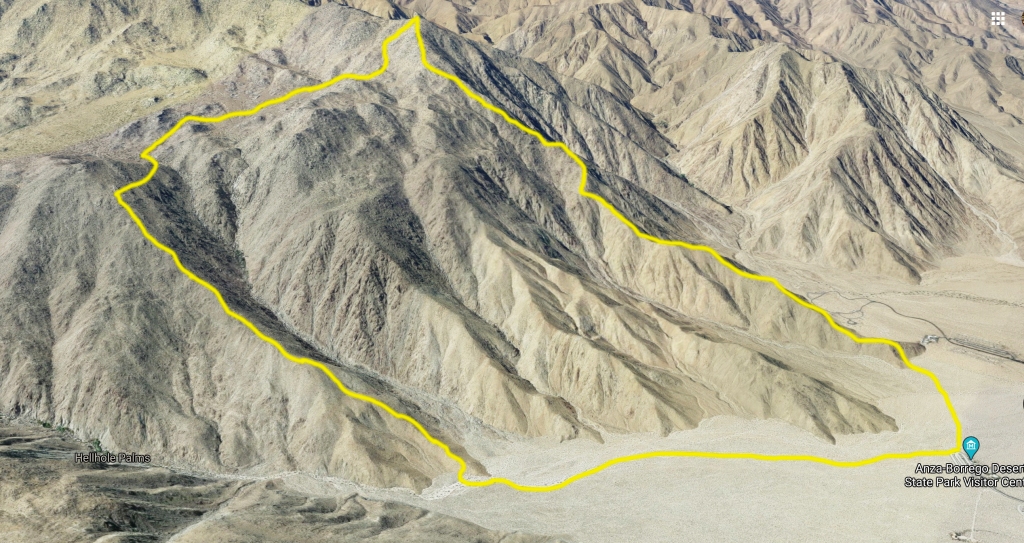
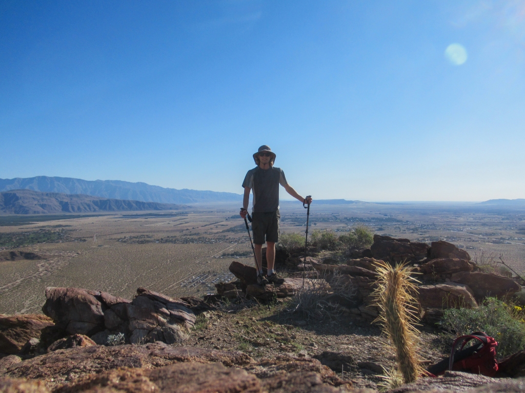
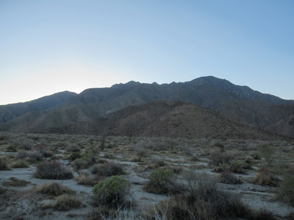
One peak to consider for those who can’t get enough of these torturous climbs: San Ysidro Mountain’s east peak, which looms over the town of Borrego Springs.
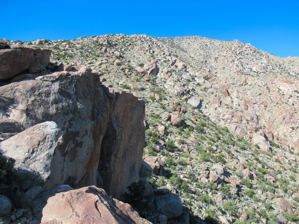
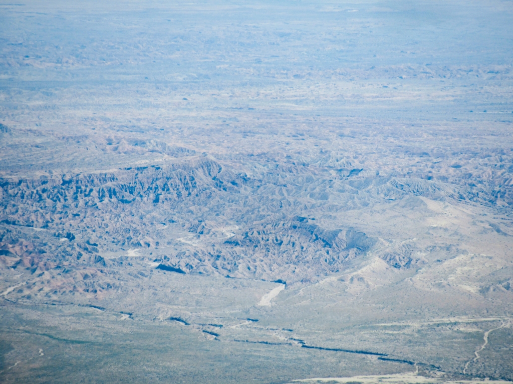
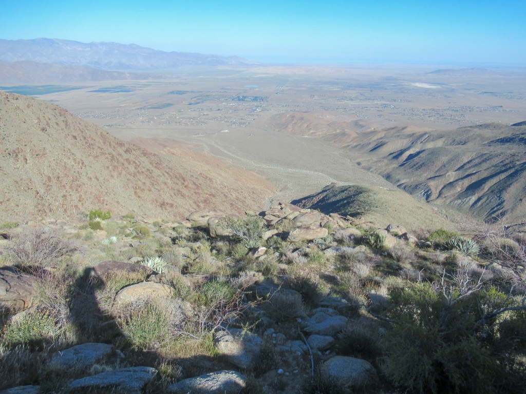
From the flat desert floor, the route to San Ysidro Mountain follows a protruding ridge that abruptly soars 4,500 feet in under 3 miles. A hike that begins with a well defined trail becomes exponentially more difficult as steep, unruly rocks and vegetation take its place.
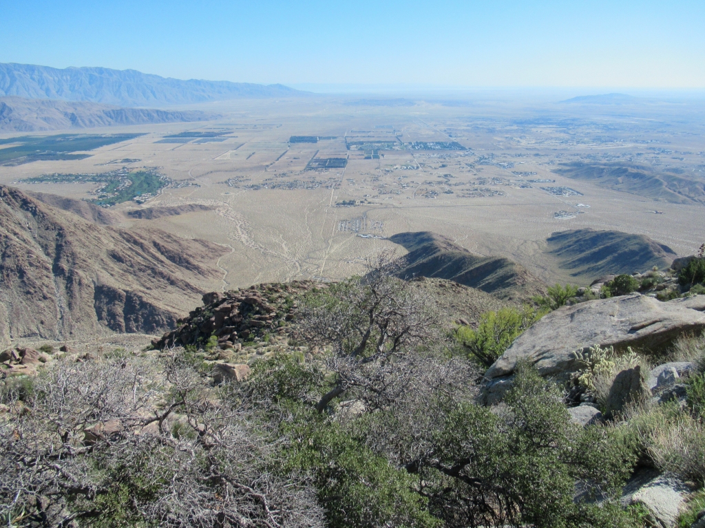
A successful trip to the top bestows hikers with panoramic views of San Diego’s highest peaks to the west, the snow-capped San Jacinto to the north, Borrego Springs and the Salton Sea far below to the east, and even distant Mexican peaks to the south.
I always enjoy loop hikes because you don’t have to repeat the same trail, so instead of making this an out and back trip, I turned it into a mountainous loop back down to the desert floor.
For those looking to cross another San Diego peak off the list, this one comes well-recommended.
When plan A and B fall through
My hiking plans for this trip went through a few drastic changes in the 24 hours prior to leaving. First, I had wanted to do an overnight backpacking trip, connecting the east and west peaks of San Ysidro Mountain — an admittedly ambitious idea to start with given I couldn’t find any mention on the internet of anyone completing such a trip. However, a rain storm with strong wind was forecast to hit San Diego on Saturday, which made me decide that it was not a great idea to venture into the wilderness on my own. The wind on the east side of the coastal range can be ferocious and gusty, so I opted for plan B: a day hike the following day when the storm cleared.
I figured with the light pack weight of day hiking, I could complete the same route if I got an early enough start. Those plans were thrown to the wayside as well when I overslept my alarm clock. Missing my 3:30am alarm, I didn’t get on the road until 6am, at which point I had accepted that San Ysidro east was going to be the farthest I could go. After seeing the terrain up close, I realized that was probably as far as I was ever going to make it regardless.
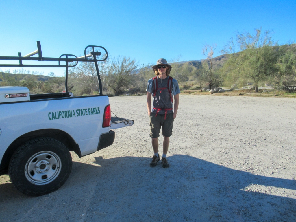
I hit the road to Anza Borrego, about a two-hour drive from coastal San Diego, arriving at the state park visitor center just before 8am. The visitor center is one of the few places (or maybe the only place) that charges to park in the area, but it is the ideal starting point for this hike. I’m happy to cough up the $10 parking fee with all the time I have spent in Anza Borrego.
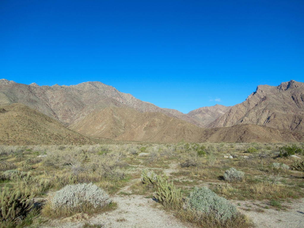
The aforementioned storm was still going strong on the western slopes of the coastal range, but on the eastern side of the mountains the sky was spotless, an excellent day to be outdoors and hiking in the desert.
Staring up from the desert floor
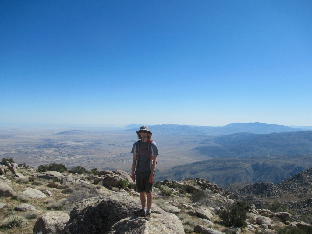
From the visitor center I made across the flat, desert plain of Borrego Springs to the ridge of San Ysidro Mountain, which guides you all the way to the peak.
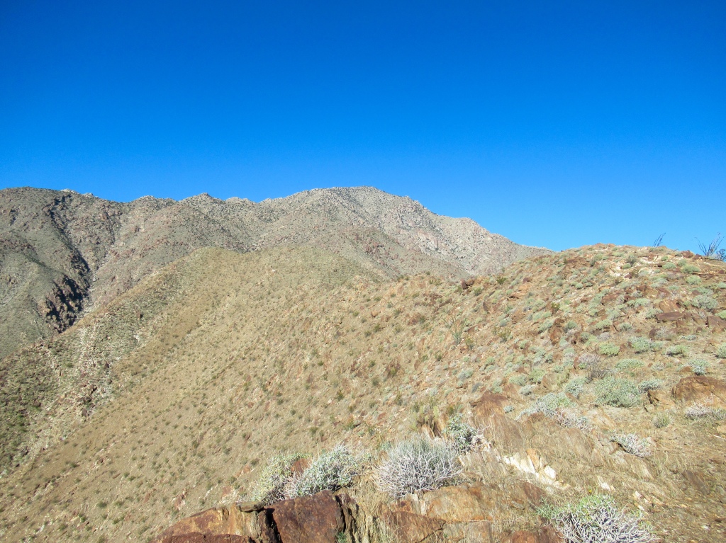
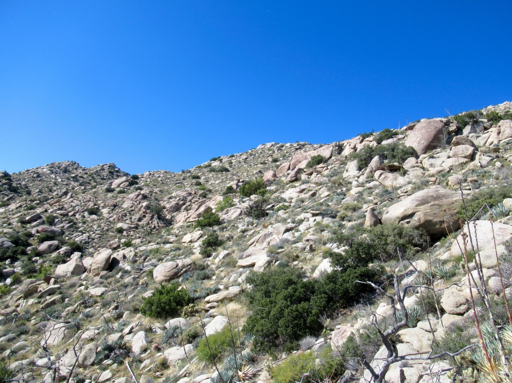
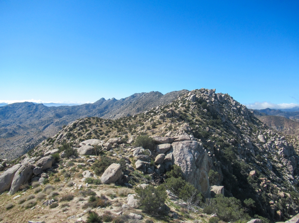
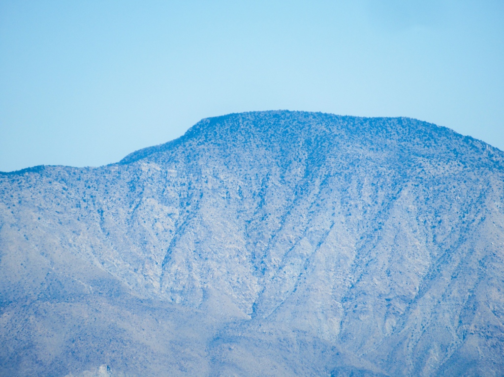
As I ascended the ridge, the views became increasingly spectacular of the surrounding desert and mountains. A relatively worn trail guided me along the ridge, with rugged slopes swiftly falling off into canyons on either side. I was making such fast progress that I began to think I would be at the summit in no time. However, to humble myself from my perceived record pace it was important to remember two things: 1) a peak is always higher than it looks once on its slopes and 2) the terrain becomes exponentially tougher on the higher slopes of San Ysidro, resulting in painstakingly slower hiking.
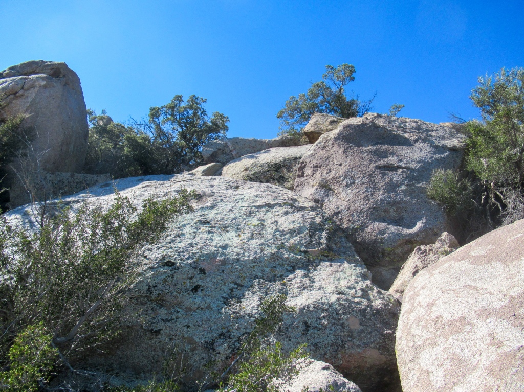
Once about half way up the ridge I started to get my money’s worth. The trail disappeared and the hiking became much more challenging and technical. The peak which had been getting steadily closer by the minute, began to stand still in the sky as my pace slowed.
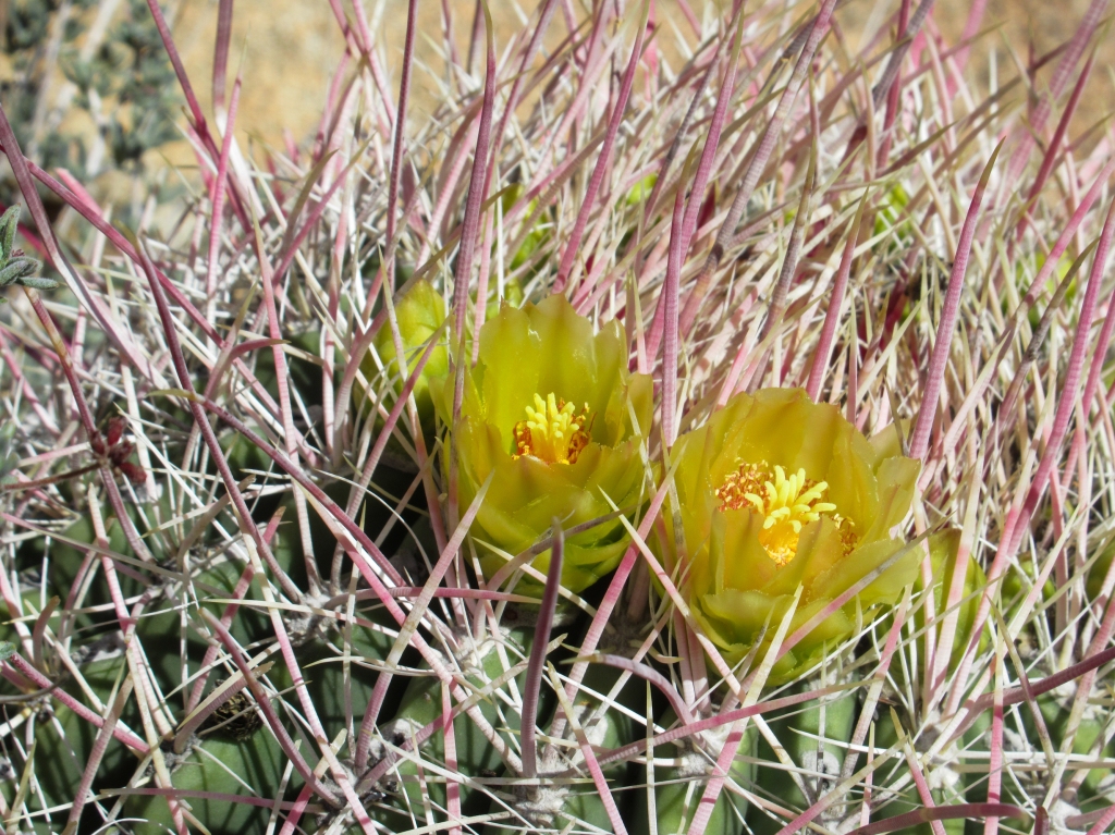
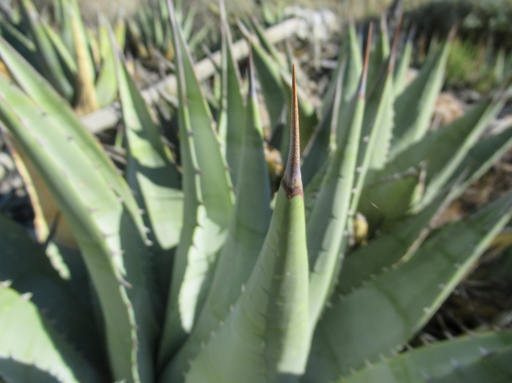
Boulders of all shapes and sizes imaginable now stood between me and my goal, as the tangled cacti and razor sharp agave only grew thicker with elevation.
There were infinite angles to which a hiker could approach the slope, and that’s secretly where all the fun lies for those who enjoy these agonizing hikes.
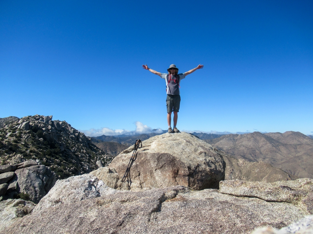
Another peak in the bag: San Ysidro east
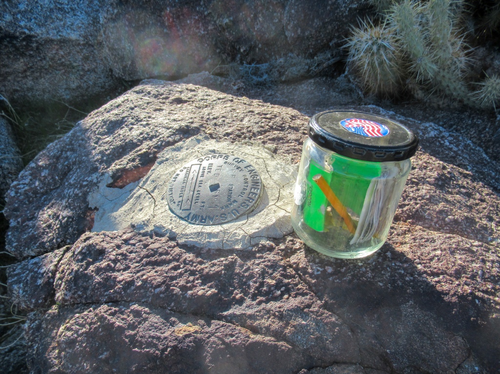
A few more brutal pushes up the steep mountain slope and I was standing atop the peak of San Ysidro east. At over a mile high, it towers over the town of Borrego Springs.
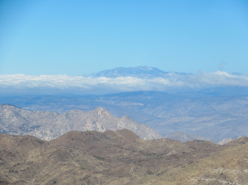
While about a thousand feet below the west peak, which was my pre-missed-alarm target, the view from the east peak was not too shabby after all, as good as advertised in all directions.
The Salton Sea was visible to the east, but just barely through a light haze on the horizon. To the west, the coastal region of San Diego could be seen still enveloped in a thick blanket of moist clouds.
As I soaked in the views, I admired peaks that I had climbed in the past from a new perspective, such as Whale Peak, Rabbit Peak, and Villager Peak, sparking fond memories of similar mountain climbs.
In no rush to head home, I kicked off my shoes, signed the peak register, had a snack, and enjoyed the vastness of the desert.
The long way back to the parking lot
The fastest way back to my car would have been exactly the way I came, but in the spirit of exploration, I decided to turn the hike into a loop and take a more interesting route back.
My plan was to drop into the high plain of Hellhole Flat, traverse over to another peak marked ‘Webo’, and then descend via the ridge that extends down to the desert floor.
Creating my own freestyle route made for more slow hiking, as the vegetation was thick and overgrown. My shins paid the price with numerous shrub scratches, cactus pokes, and agave stabs.
I had my eyes peeled for remnants of the Native American inhabitants that once roamed these lands — morteros, pottery, rock shelters, petroglyphs — but I found none. I meandered around checking out a few promising leads, but I was essentially trying to find a needle in a haystack at best.
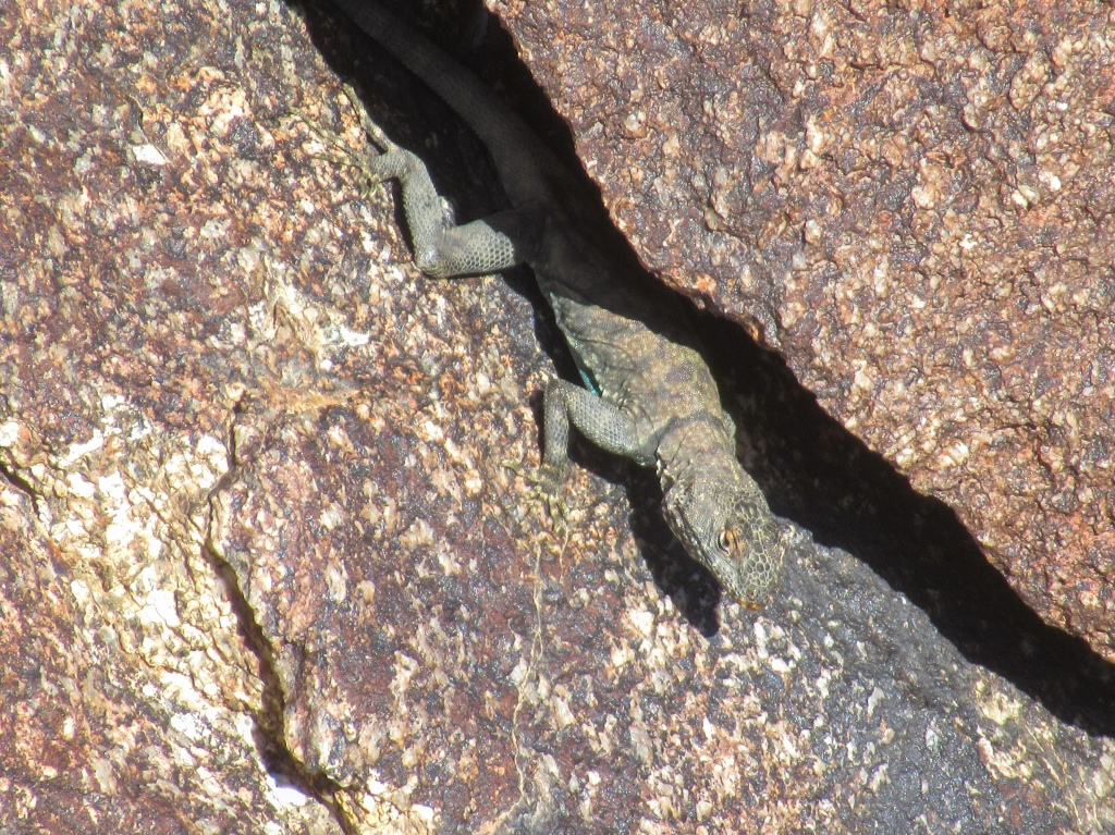
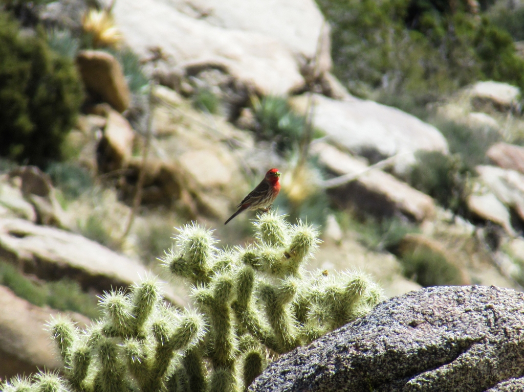
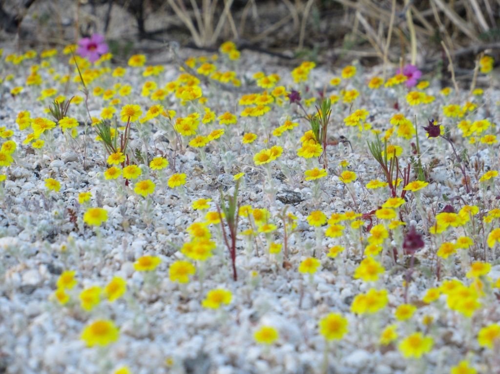
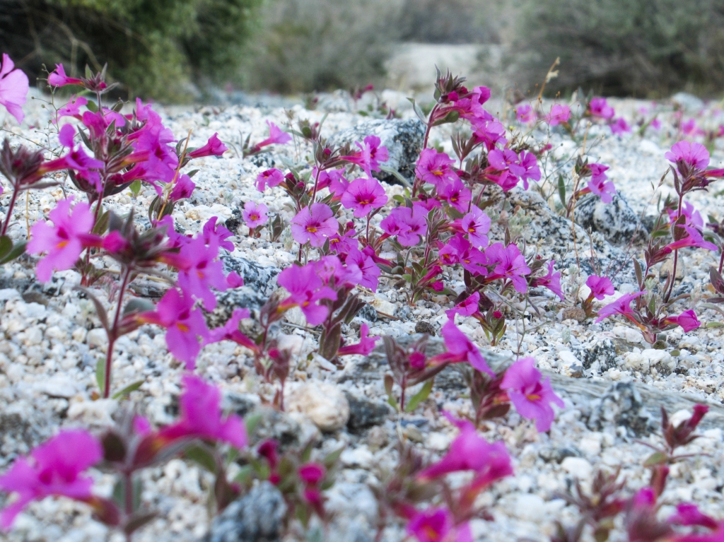
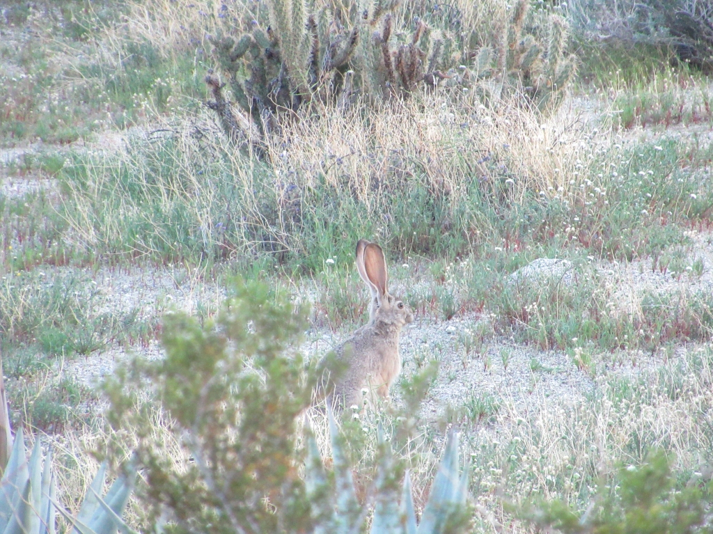
Observing the various flora and fauna through this new path down made it well worth it, as I spotted some new birds, plenty of jackrabbits, and flowers that I had not seen on the route up the mountain.
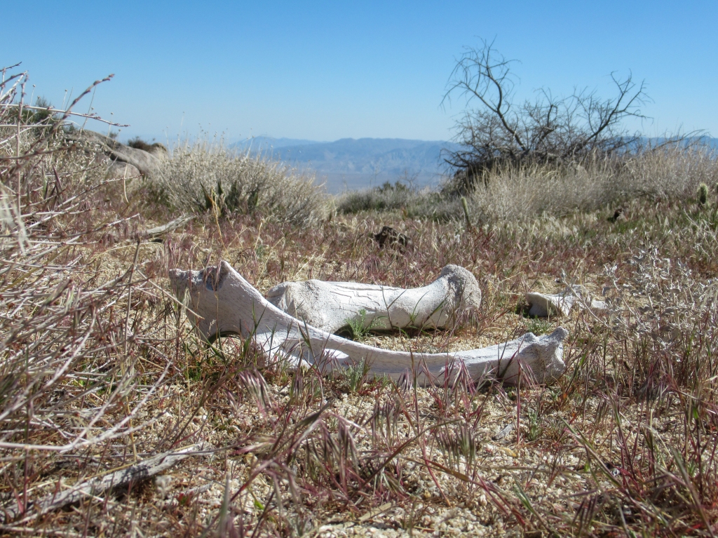
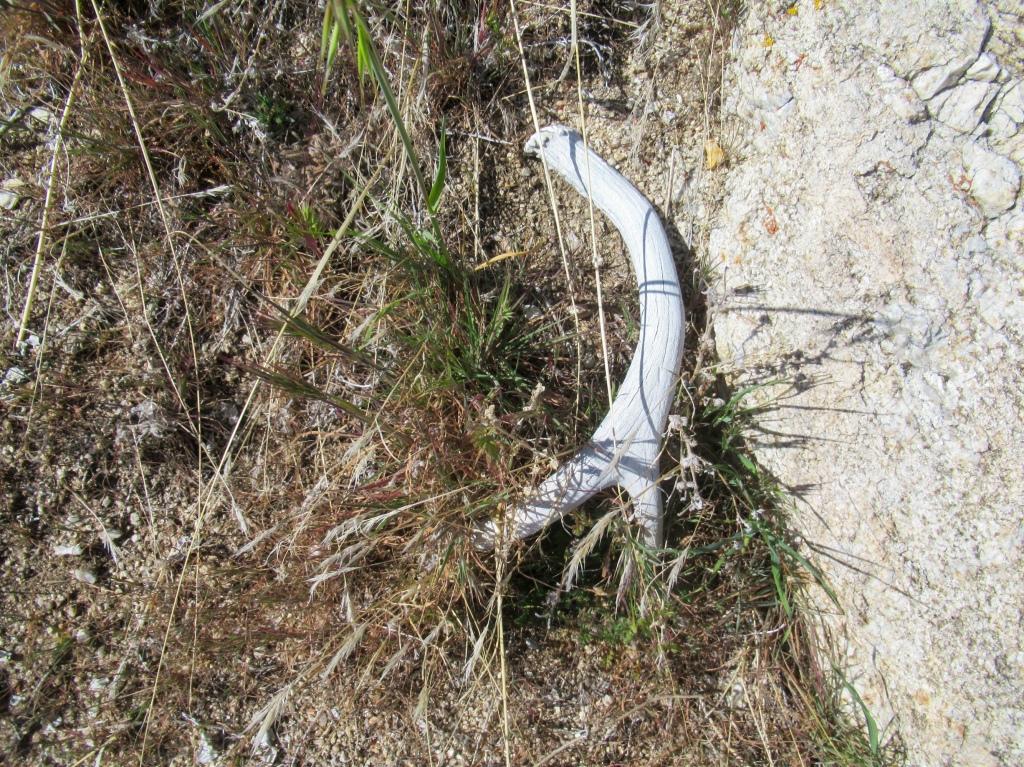
The hoof prints and droppings of bighorn sheep were abundant as I explored the new ridges and valleys. I was hoping to catch a glimpse of the animals, but they eluded me. I’ve still never seen the famous sheep that the park takes its name after in all my dozens of hikes in Anza Borrego. I get jealous when I see tourists post photos of them from the side of the road when simply passing through.

Another day, another peak
San Ysidro had checked all the boxes for me. My craving for a challenging desert hike had been curbed for the time being, yet I knew that was only a temporary satisfaction because a Monday spent in an office recharges that desire exceptionally fast.
In fact, as I write this, only a few days after my hike, I find my attention span fading as I switch over to Google Maps, scouting new peaks to summit. After all, desert hiking is a seasonal sport — like skiing or bobsled — and knowing that these peaks will be off limits when the unforgiving heat returns in a few short months only adds to the vigor and want.
San Ysidro east has been added to the ‘bagged’ list of peaks. Now it’s onto the next one. And I know someday I’ll be back again to go conquer that west summit.

Right on, Evan! Borrego is the place to be, I’ve been working here for 2 years and the exploration is endless. I’ve actually been wanting to do this climb since I see it pretty much every day all day. Gonna do Rabbit again next month with some buddies. You should know about a guy named Sicco Rood who works at the UCI reserve down here (Steele-Burnand Research Center). He’s done the Santa Rosa Traverse. Basically you start as if you’re doing Rabbit, but finish at Toro peak. Dawn’s peak is the real breaker on that hike according to him.
LikeLike
Thanks. I’ve been wanting to do Dawns Peak from Clark dry lake. Looks like a good challenge. Maybe I’ll try that this winter.
LikeLike
Another fabulous article! I really appreciate the time you put into your writing. There is such a beautiful flow & I love your photos. I also love exploring new places & experiences through your articles. Keep up the adventures!
LikeLike
Did you notice any bees in the flowered areas? Great article and photos, thanks for the walk-along. Dad
LikeLiked by 1 person
Yes, lots of bees.
LikeLike
Your narrative made me feel like I was actually there. Especially lived the pictures of flora & fauna.
LikeLiked by 1 person
Great article and some nice photos
LikeLiked by 1 person