Throughout the past few pandemic ridden months, backpackers in California have been keeping a close eye on antiquated government webpages, searching for updates on the closures of the state’s many outdoor recreation areas.
Months of page refreshes and numerous unsuccessful phone calls proved fruitless until promising news struck on June 1: Much of the Sierra Nevada — California’s largest mountain range — would open for wilderness permits (aka backpacking).
Living in San Diego, the Sierras are not exactly close compared to other suitable camping areas in the region, but this year I wanted to commit to the extra hours of driving. The Sierra Nevada is world-class hiking, featuring an innumerable amount of crystal-clear alpine lakes, thousands of miles of trails that pierce the most remote corners of the country, and the highest peak of the lower 48 states.
However, one does not simply waltz into the Sierra Nevada and backpack, at least not legally. To keep these lands from being over-loved by people, there is a quota for the number of people that can backpack on a trail on any given day. I went online with a friend, did some research on the areas that I wanted to hike, and started booking up trips through summer’s end.
First up on the docket was Kearsarge Pass.
Part 1: Climbing to Kearsarge
Kearsarge Pass is an old mountain route built by mine prospectors in the 1860’s who were looking for another path to into the heart of the Sierras.
A steep 2,500-foot climb through a staircase of ice-cold lakes and gushing rivers takes you up to 11,709 feet of elevation at Kearsarge Pass — the entrance into Kings Canyon National Park and a portal to the stunning scenery of the range’s interior.
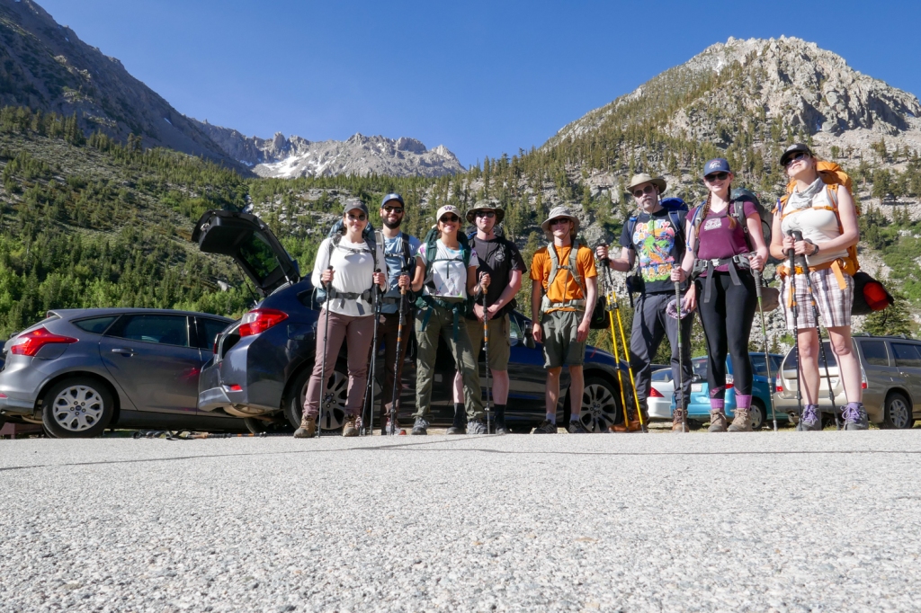
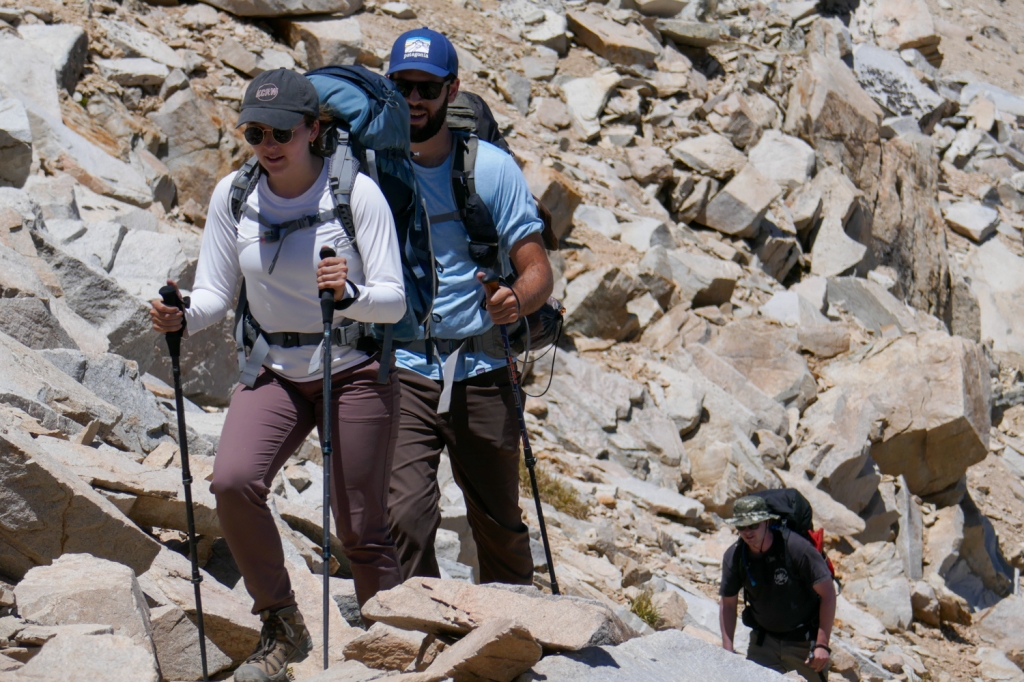
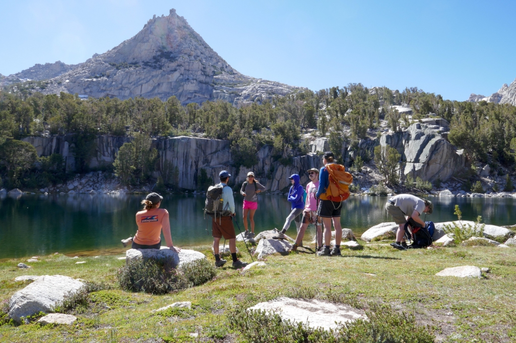
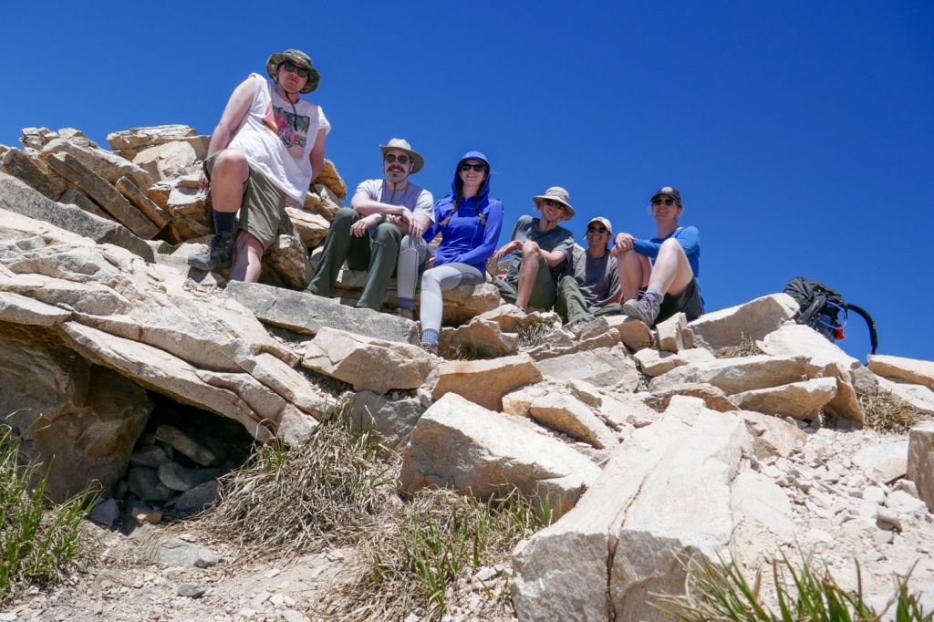
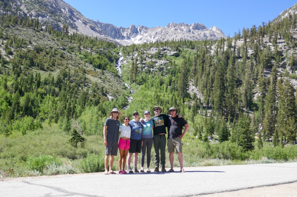
I ended up assembling quite the crew for a three-night excursion over Kearsarge Pass, getting together all three of my siblings, my girlfriend, two friends, and my sister’s boyfriend for a grand total of eight people.
We spent the night before our trip camping in the small town of Independence, nestled in Owens Valley thousands of feet below the pass. As we slept in the arid, dusty heat on the fringes of the Mojave Desert, we could hear the powerful, flowing alpine creek water rush by our tents, a hint of what awaited more than a mile above us in the sky.
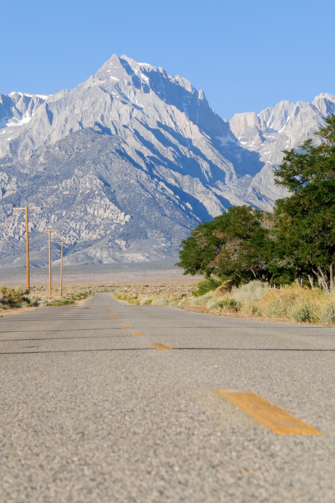
The following morning we commenced the journey at 9,200 feet of elevation at Onion Valley Campground, a popular resupply point for hikers doing long journeys through the mountains.
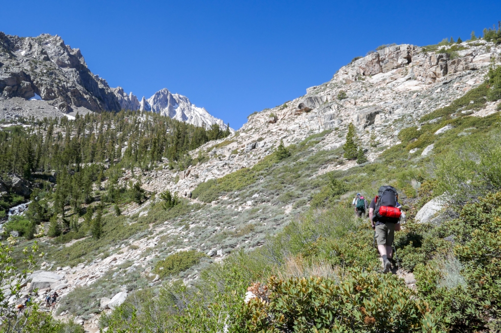
Immediately the trail uses a series of blood-pumping switchbacks to start gaining elevation. When you hike in a group that large, everyone has their own break schedule, bladder schedule, and alimentation schedule, so I wasn’t expecting us to break any speed records.
The weight of our heavy day-one packs and our oxygen deprived lungs didn’t make matters go any faster. We trudged in our separate packs slowly up the mountain, averaging less than a mile per hour.
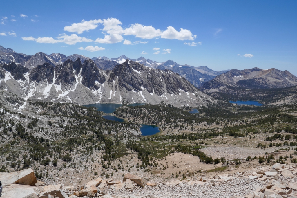
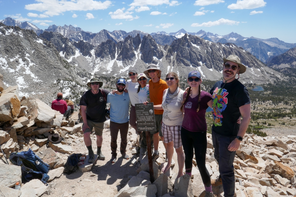
After much physical exertion and plenty of trail conversation to catch up with people we hadn’t seen since the onset of the pandemic, eventually we topped out at Kearsarge Pass, gaining our first glimpse of the mountains, valleys and lakes to the west.
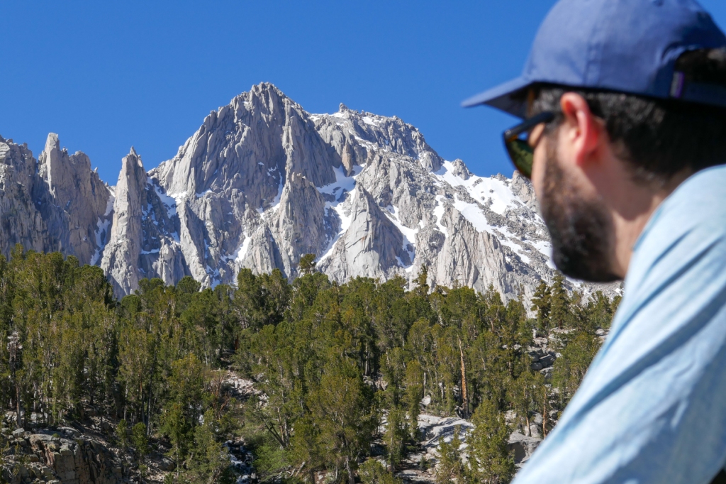
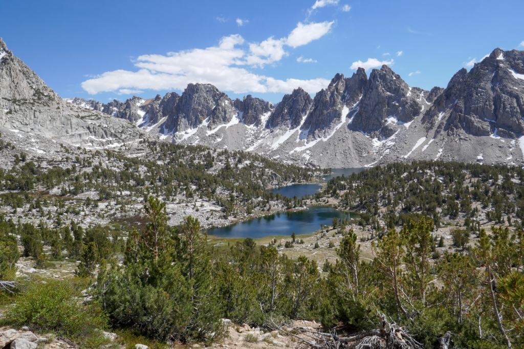
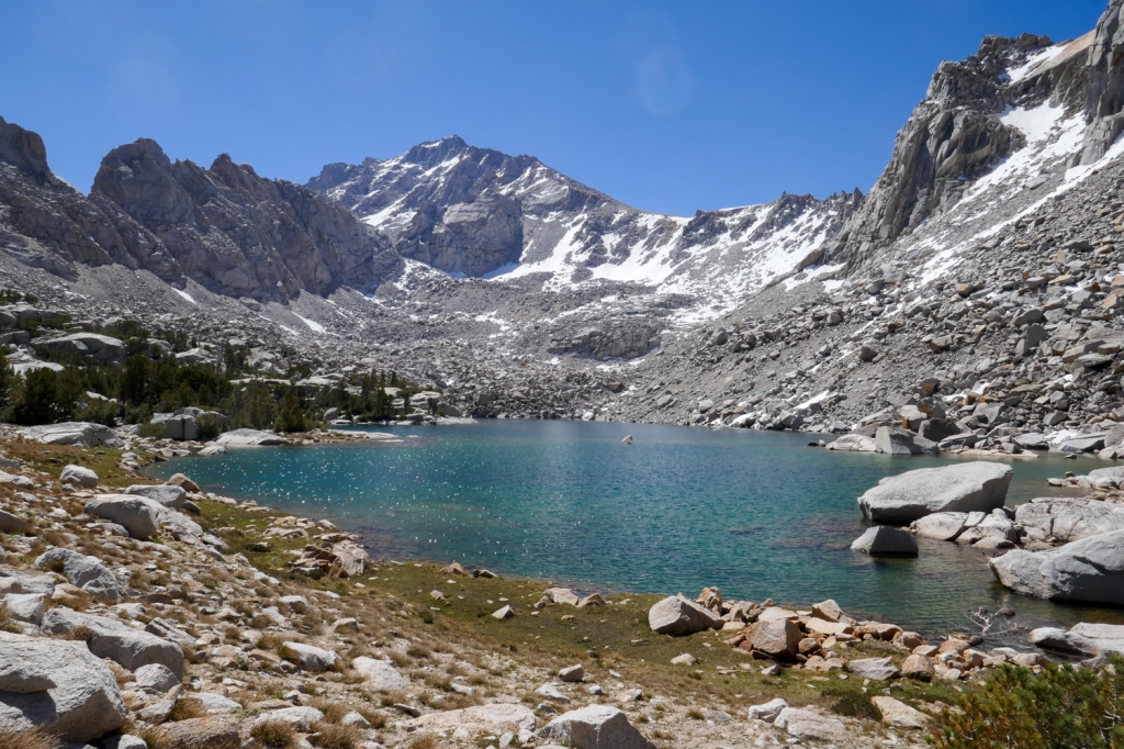
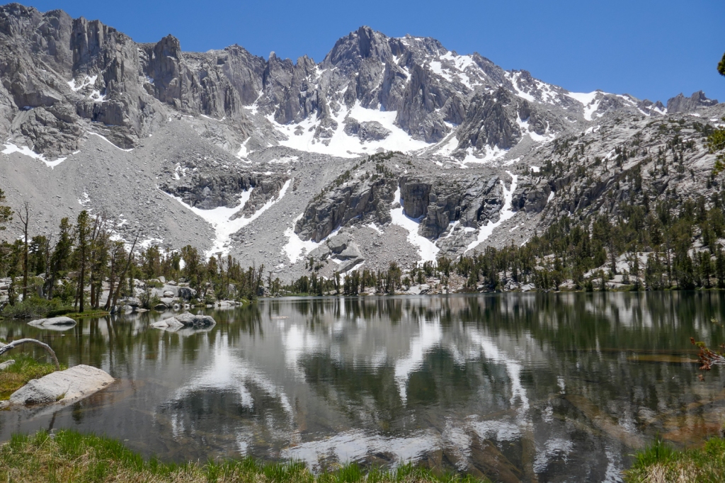
From the pass, the craggy Kearsarge pinnacles dominate the scenery, with the 13,500-foot, snow-capped University Peak looming to the north. Peering far to the west you could make out the drainage of Kings Canyon, gathering immeasurable amounts of alpine water before it gets whisked away on a journey into the Central Valley and, eventually, the San Francisco Bay.
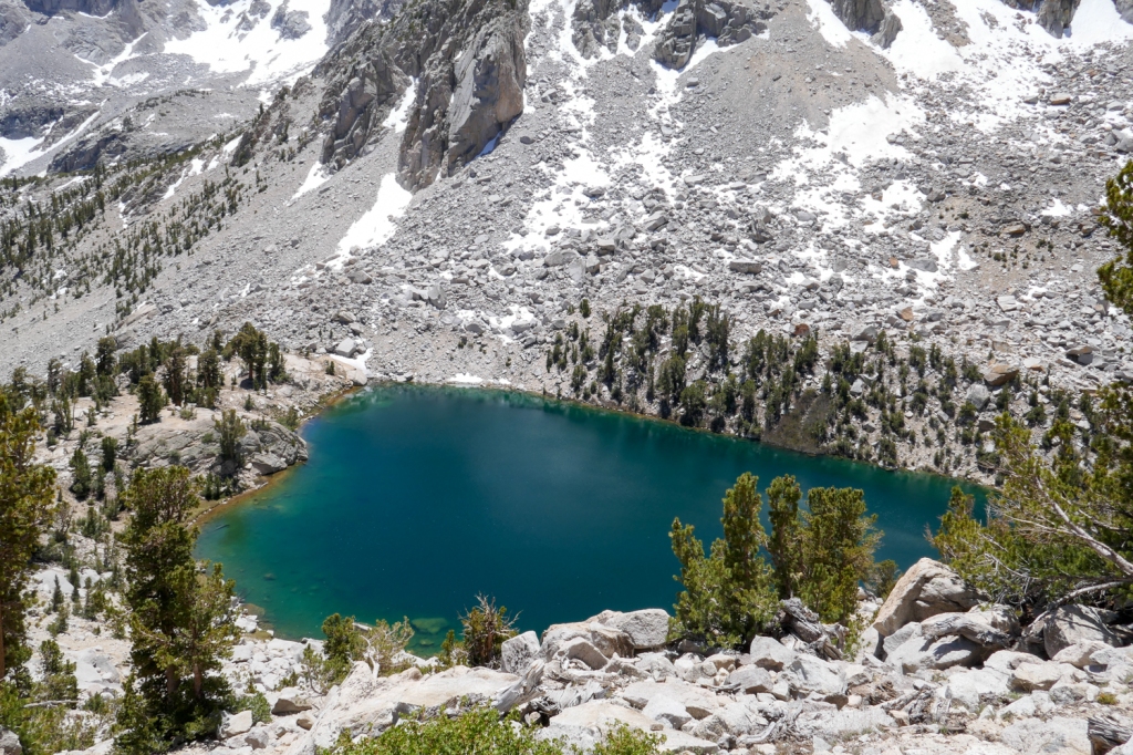
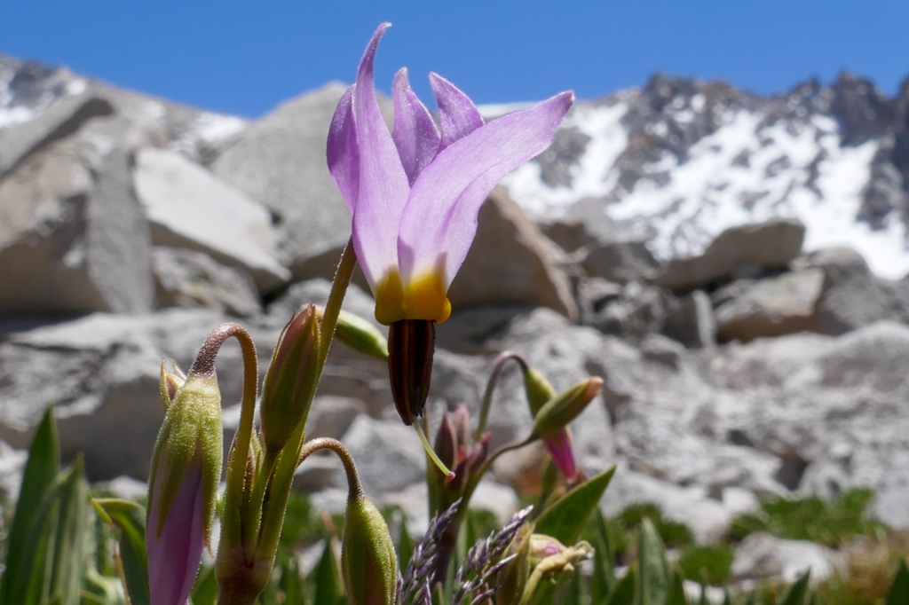
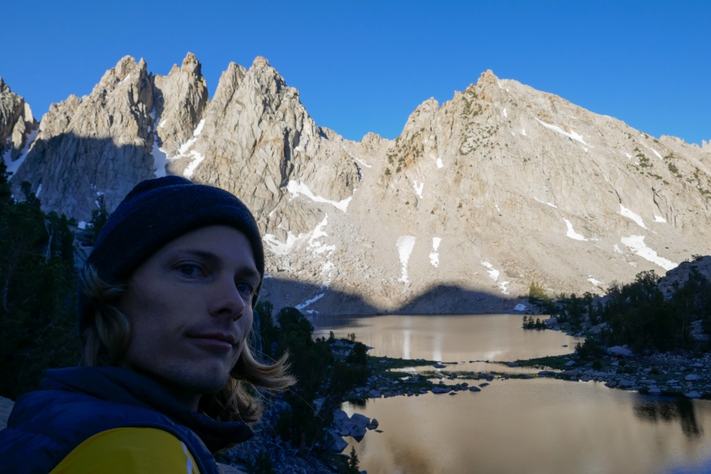
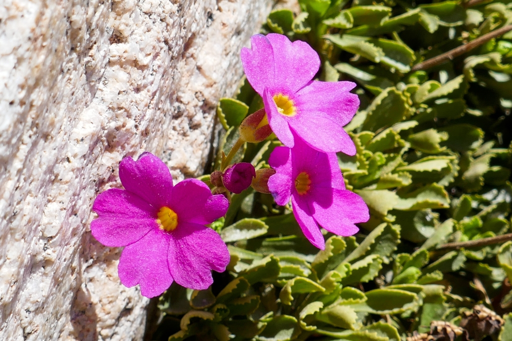
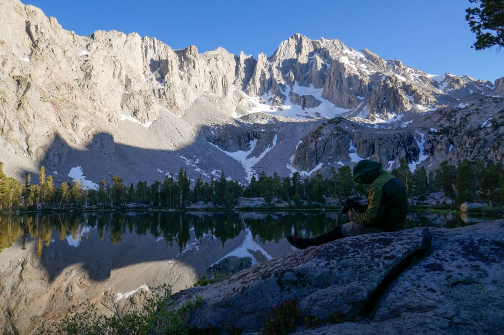
Down in the basin below the pass were the Kearsarge Lakes, revealing their deep-blue tones that are contained by granite cliffs, lush grass, and loose scree.
The Kearsarge Lakes were our destination for the first night, so we descended the pass under the afternoon sun, yearning for a dip in the lake before the evening temperatures dropped.
Part 2: Polar plunges in the Kearsarge Lakes
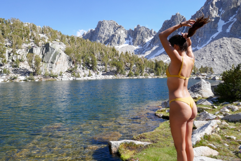
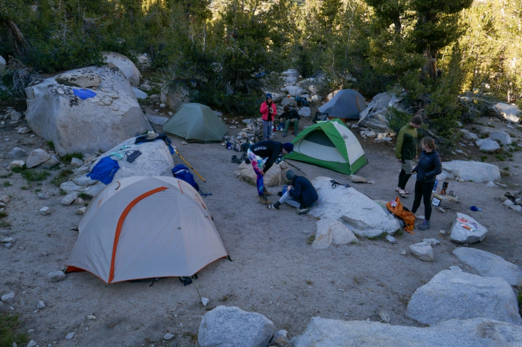
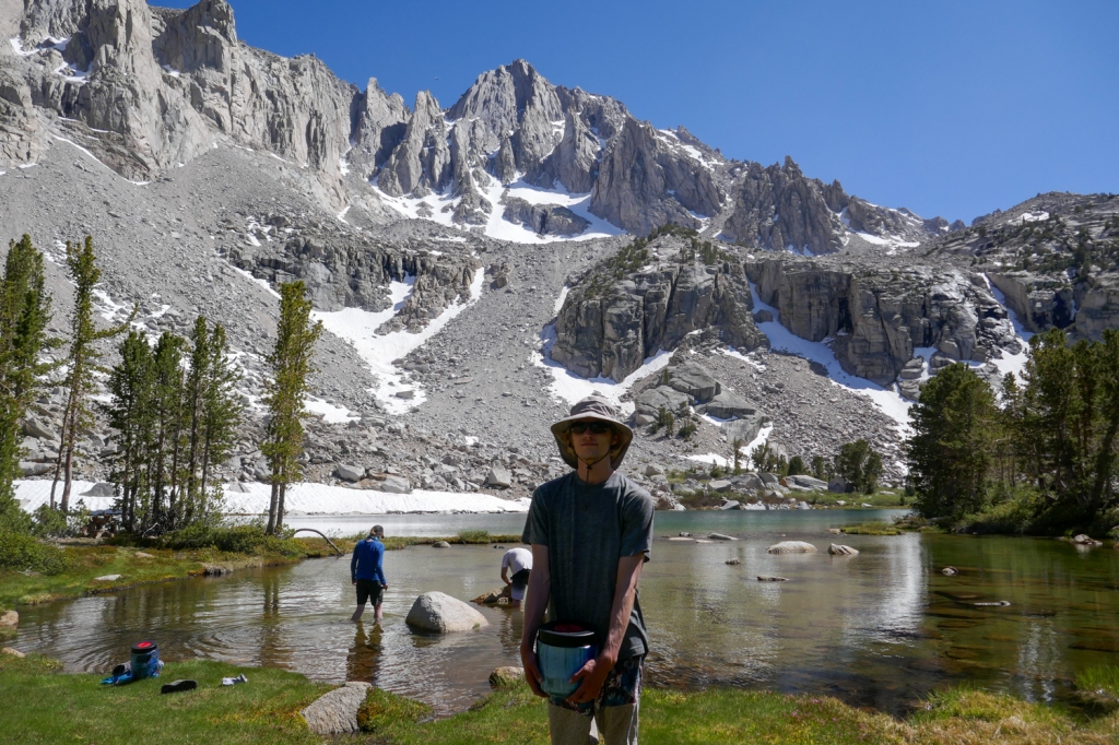
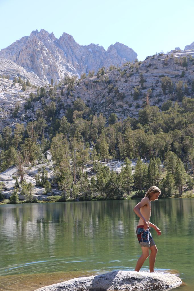
Battered and beaten, we arrived at Kearsarge Lakes and immediately searched for a spot to pitch our tents. Our late afternoon arrival meant that we didn’t get first pick at a campsite, but soon enough we found an ideal, secluded area a legal distance from the water (200ft) with ample room for our four tents.
First things first, a dip into the lake was in order to wash off the layers of dirt that we had all accumulated during the climb.
Given the nearby snow fields feeding these lakes, it was no surprise to discover that the water hadn’t warmed up a whole lot since its short journey from snow drift to lake. It was frigid enough to knock the wind out of you and render your extremities useless upon diving in.
Our group didn’t last more than a few seconds each fully submerged, but a brave soul who was camping near us somehow mustered up the strength to swim across the lake from end to end, a task that we thought silly due to the risk of your muscles tensing up far from shore.
Fresh water and a bath renewed group morale as we gathered around the tents to feast on our freeze-dried meals. Birds sang in chorus as crisp mountain wind rustled the tree branches, and best of all, our cell phones didn’t (couldn’t) make a peep with no cell tower near enough to penetrate into this deep wilderness. It was an ideal end to our first day on the trail.

Part 3: Missing out on University Peak
I always enjoy the challenge of bagging a difficult peak. For this trip, I had my eyes fixed on the highest peak in the immediate area, University Peak.
From the approach in Owens Valley all the way to Kearsarge Pass, University Peak towers above the trail. With no official route to the top, I had been eyeing the slopes, ice fields, and ridges, scanning my trail to the peak.
I had particularly wanted to get this peak because at 13,589 feet tall it was about 500 feet higher than my current highest peak record.
The front side of University Peak, which can be hiked, is a dramatic, steep series of cliffs and pitches. It looks quite intimidating. My plan was to gain the mountain’s southwest ridge and hike the south face. In the northern hemisphere, the south side of a mountain will always receive more sun than the northern side, usually leading to less snow.
On the morning of day two, the group did a little scouting mission, hiking to Upper Kearsarge Lake to explore the area and see if the peak was doable.
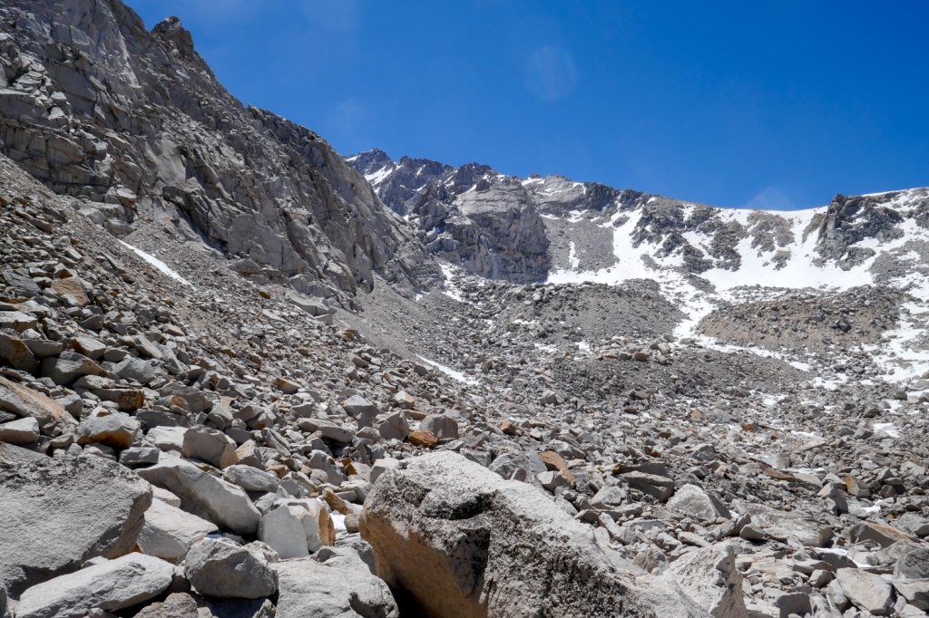
This early in the summer, the snowpack was still rather heavy starting from around the 12,000-foot mark. I scanned the various chutes and ridges looking for an easy way up, but every feasible route was either blocked by steep, flaky snow fields or vertical cliffs.
A few of us decided that, since we had the whole day ahead of us and nothing else to do, we might as well hike further up the mountain to get a closer look at the options, and if it wasn’t doable, we’d just turn back around and enjoy the day at the lake.
It didn’t take much hiking past the upper lake to realize that the peak probably wasn’t going to be possible. The granite boulders grew in size on our path, making our progress slow down to a snail’s pace. Then as we approached the snow fields on the top of the valley, we could tell that the quality of the snow would not let us go any further. Below the frail, summertime snow was rapidly gushing water. A wrong step could send you falling an unknown distance below the surface, chances that weren’t worth taking.
We discarded our plans for University Peak in exchange for a relaxing day at the lakes. University Peak seems to be best done in the late summer or fall. We’ll be back.
Part 4: Matlock Lake is a frog success story
For day three of the trip we wanted to get a manageable distance closer to our car to make our long drives home a little easier on the final day. That meant hauling our packs back over Kearsarge Pass and looking for a place to camp.
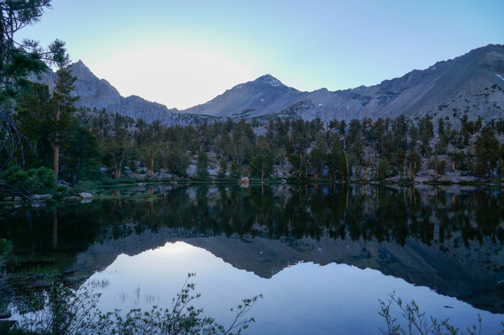
I keyed in on Matlock Lake due to its location off the main trail and ideal position to view the impressive north face of University Peak.
With just 1,000 feet of climbing and our improved acclimation to the altitude, we made fairly decent time heading back over the pass. Crossing on a weekday proved to be much more peaceful than on a weekend, as the crowds were much thinner.
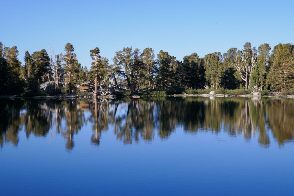
We scurried back down the trail and made for Matlock Lake, another pristine body of chilly water above 10,000 feet in elevation.
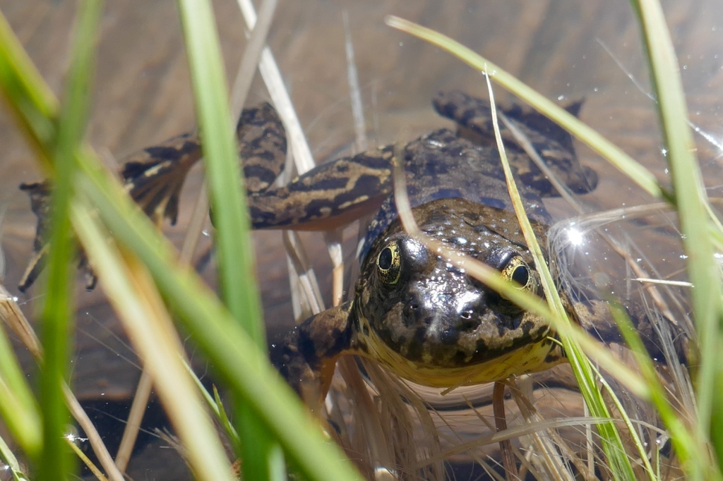
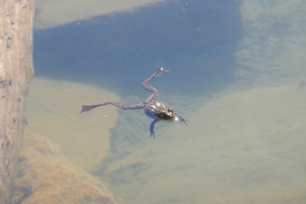
From previous chats with fellow hikers on the trail, I was notified that the lake was full of frogs, and this proved to be quite true. We approached the lake and walked its muddy banks, where hundreds of frogs would dive into the water, almost in synchronous motions.
Unlike Kearsarge Lakes, Matlock was devoid of fish. Fisherman may gripe about it (I saw a few attempting to cast in this lake), but it’s actually an intentional act to return balance to the environment.
Trout are native fish to some of the lakes in the Sierra Nevada, however they are heavily overstocked by humans. In the 50’s and 60’s airplanes poured these little fish into the alpine lakes throughout the range, to improve the fishing conditions that fuel tourism. Lakes that had never had fish began to teem with trout.
And, of course, such human intervention didn’t go unnoticed by the ecosystem. The yellow-legged frog paid the price with their habitat being overrun by fish. The situation was so dire that the frog made it onto the endangered species list.
In the past decade or two, there have been efforts to save the frogs of the Sierra, and Matlock Lake is one of these examples. In the 2000’s the fish were methodically removed from the lake, and lo and behold the frogs began to thrive, significantly rebounding in numbers.
In fact, the frogs were so plentiful, we had to be weary of our steps as to not accidentally crush them.
We enjoyed another sunny afternoon dipping in the icy lakes alongside the frogs. I admired the views of University Peak until the daily dusk swarm of mosquitos shoed us back into our tents for one last night in the wilderness.

Part 5: Back to reality
Every good backpacking trip comes to end. We gathered up our belongings and made the relatively quick descent back to Onion Valley where our cars were waiting.
We were all dying to eat some fresh food, especially me and Madison because we had miscalculated our daily food allowance and were slightly calorie deprived by the final day.
Kearsarge Pass had been a success — the first backpacking trip that I had ever done with all three of my siblings. The pristine lakes, alpine forest, and sweeping vistas had all lived up to expectations and only left us looking ahead for the next trip.
The pandemic, which has thrown everyone’s lives for a bit of a loop, may have a silver lining for me. I am finally home for an entire summer (I typically travel a lot for work) and have the ability to explore some new corners of the Sierra Nevada. I have at least two more trips lined up, maybe more.
You can expect more of the same from the rest of my summer.

Great report, Evan. I’ve done very few backpacking trips in the Sierra compared to the number of mental trips I’ve taken while pouring over topo maps of the range. Kearsarge Pass is one I’ve spent a bit of time looking at, so it was great to see real photos of it. All the photos were great, but I especially loved the first shot of Matlock Lake. Absolutely stunning! When I saw in one photo that you had the smaller BearVault 450 it seemed like it would be tough to fit food for two for a 4-day trip, so I wasn’t shocked when you said you ran low towards the end. But then, I always pack far more food than I need. Haha.
LikeLiked by 1 person
Looks amazing! definitely on my bucket list
LikeLiked by 1 person
Beautiful place!
LikeLiked by 1 person
I always love receiving your articles! You paint beautiful pictures with your words. Your photos and Madison’s are fantastic! Thanks again for sharing your adventures! I love that part of the world.
LikeLiked by 1 person
Thanks for the positive feedback.
LikeLike
So happy all my kids got to enjoy this adventure. Love the photos and great storytelling. Adventure on! XO
LikeLiked by 1 person
Good guess; I’d say, It’s most likely you’ve heard it pronounced rather than seen it in print, I mean the “Lo’ and Behold!”
LikeLiked by 1 person
Great photos & well-written blog! I love the Kearsarge Basin. My husband, son, and I slogged up the pass carrying a resupply to a friend & her kids who were doing the JMT, so we weren’t in much of a mood to enjoy the views until on the way back!
LikeLike
Now that is a good friend.
LikeLike
Evan, love the article and pictures! I did the hike years ago from Onion Valley into Kings Canyon, did encounter a few bears. This article and especially the fabulous photos brought back memories!
LikeLiked by 1 person
Lynn, my awesome colleague and friend! You two need to meet…you have adventures to share
LikeLiked by 1 person